 Monday, July 6, 2009
Smoke
Location For The Night: Mahoosuc Guide Service, Grafton Notch, ME
Miles Walked Today: 16.30
Day Number:
19
Today Flaxseed and I were up, packed and walking at 5:30am. The sky was clear and the sun was coming up. It was a joyful morning.
We hiked over Wyman Mountain and down to Frye Notch (notches are called gaps down south) where we ate lunch in the lean-to there.
It was there at lunch that Flaxseed revealed to me the real reason he did not climb Mt. Katahdin with me back at the start of this thing. When Flax summited Katahdin in 2007 his through hike for that year was over when he got to the top. Then he had to descend the 5.2 miles for which he got no credit. For Flax this was a challenge. He said to himself, "Darn if I'm going to hike these 5.2 miles for nothing. I'll just have to come back up here and finish this thing." And that's exactly what he's doing. He didn't bypass Mt. Katahdin at all. He simply started early, on August 26, 2007.
At 2:30pm today we reached the top of Baldpate Mountain east peak. We had an exquisite view in all directions. Looking to the south, we were trying to determine which mountain was Mt. Washington, the highest of the White Mountains' Presidential Range, where we will be in a couple of days. We picked out the tallest one but couldn't be sure. But, about 5 minutes later, as we were traversing the bald pate of Mt. Baldpate, Flax said, "Look Ringmaster, smoke. That's smoke from the Cog Railway engine that goes up to the top of Mt. Washington." And sure enough it was. We could not see the train of course. We are still 25-30 miles away. But the smoke from the engine was clearly visible as the little train inched its way up the mountain. Pretty neat.
Also on top of Mt. Baldpate I made a phone call to Polly at Mahoosuc Guide Service to reserve us bunks for the night. At 6:00pm we arrived at Grafton Notch, Maine Rt. 26. Kevin Slater, owner of Mahoosuc Guide Service, picked us up at the trail head. Kevin and Polly are remarkable folks. Look them up at www.mahoosuc.com.
We got showers and Kevin did our laundry. Then he took us into Bethel, Maine, for supper and resupply. We brought a large combination pizza back for breakfast tomorrow morning.
We are back in Kevin's Lodge now. I'm typing and Flax, per usual, is already sound asleep. It's raining cats and dogs outside. What else is new?
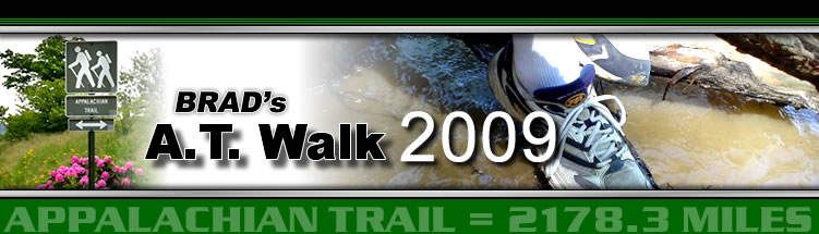
Today's photo is of some of the many rock cairns, r piles of rock, that mark the trail where there are no trees.
Today we started at Hall Mountain Lean-to, trail mile 250.5, and ended at Grafton Notch, trail mile 266.8, a total of 16.3 miles for the day.
God bless you all.
 Tuesday, July 7, 2009
Foiled Again
Location For The Night: Mahoosuc Guide Service, Grafton Notch, Maine
Miles Walked Today: 0.00
Day Number:
20
It rained all night long and we had rain, mist and fog this morning. As I said last night, "What else is new?" We tuned the radio to the one available station for the forecast - Rain, 90% today, 100% tonight with the possibility of severe thunderstorms.
It's one thing to to walk in the rain and mud and cold wind and climb two or three (or four) 3,800' to 4,000' mountains a day, but when the infamous Mahoosuc Notch is on the day's schedule one must weigh his options carefully. And one did. Actually two did. Flax and I are reluctantly and remorsefully taking another zero.
Mahoosuc Notch is 7.1 miles south of here. The guide book describes it as "the most difficult part of the AT... a jumbled pit of giant boulders." It is 1.1 miles of crawling and hand over hand climbing. Flaxseed has done it northbound. He knows exactly how tough it is when it's dry and he thought we should wait a day. I agreed. We are foiled again. But, the weather is in God's hand's, not ours, and tomorrow will hopefully be a better day.
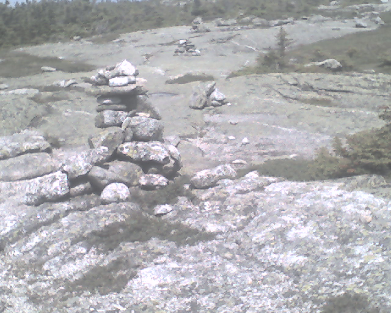
This decision has given us a chance to rest and eat and rest some more. Also, I have learned a lot about what Kevin and Polly do here at Mahoosuc Guide Service. Kevin gave me a tour and the low down. They are Maine Guides of the highest order. Kevin makes his own wooden canoes, paddles, dog sleds and snowshoes, along with about everything else around here. He says, "Them Tupperware canoes are junk. No real Maine Guide would get near one." He built their timber frame home and the timber frame lodge we are in (photo). There are no nails, screws or glue in the timber frame. It's all mortise and tenon and pegged.
In the summer they guide canoe trips and fishing trips in central Maine, northern Maine and Canada. In the winter it's guided dog sled trips. Kevin has primitive camps set up in the back country with firewood stacked and ready. They sled in and set up wall tents with wood stoves. Sounds neat.
But their first love is their dogs, Yukon Huskies. Kevin showed me around his kennels with great pride. His love for his dogs is evident. Right now, if I got the number right, they have 27 of these "mixed breed huskies from various areas of the north. They tend to be large and long legged; ideally suited for pulling heavy loads in deep snow conditions."
I was surprised to learn that the winter dog sledding trips make up the greater part of their business. The phone is ringing off the wall. Kevin says he's booked full for this coming winter. Sounds fun - but cold. Like many niche businesses Kevin says his business has really been helped by the Internet.
It's 6:00pm as I type and Kevin is going to shuttle us into Bethel for another town meal tonight at 6:30pm. I'll make this do for today as I know I'll get a signal in Bethel. By the way, in case you were wondering, it's raining outside; cats and dogs.
Zero miles today.
May God's richest blessings and His grace and mercy that is ONLY available through and by the sacrifice of His Son, our precious Lord Jesus be yours in abundance as you put your abiding faith and trust in Him.
 Wednesday, July 8, 2009
More Cold Rain
Location For The Night: Full Goose Tentsite
Miles Walked Today: 9.70
Day Number:
21
Today Flaxseed and I had a plan that involved hitting the trail late at 9:15am. It was a good plan. But we scrapped it midway through. Here's the story.
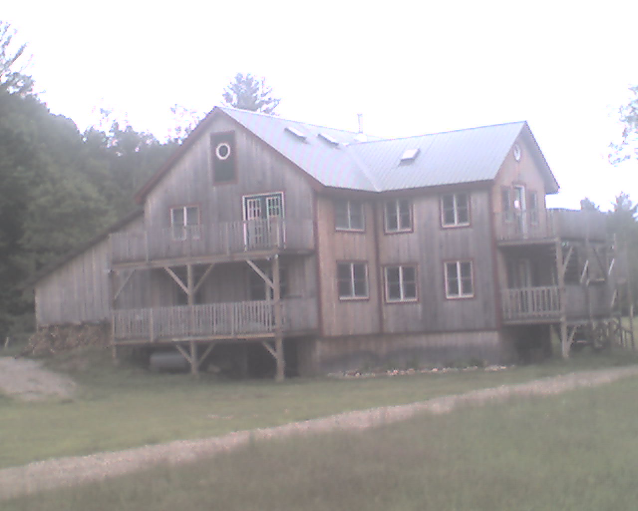
We slept in today at the lodge, a really nice place. I was up at 6:30am, Flax a few minutes later. There was oatmeal in the kitchen and we both had some for breakfast. We took our time packing and Kevin (today's photo) picked us up at 9:00am for the shuttle back to the trail. Guess what? It rained all night long and it was still raining at 9:00am - hard. And it was cold.
So, because of the continuing rain our plan was to climb Old Speck Mountain and camp at Speck Pond Shelter, about a 6 mile hike and just north of Mahoosuc Notch. The forecast for tomorrow was for clearing weather and we planned to do the Notch tomorrow. But we got to the shelter at 1:00pm, way too early to stop. So, the plan changed. We decided to hike on and tackle the venerable Mahoosuc Notch in the cold, cold rain. And we did. And we made it through.
Then we had a mile and a half left, mostly uphill, to Full Goose Shelter and Campsite. We rolled in to Full Goose at 7:14pm only to find the 12 person shelter full, not of geese, but wet hikers. Not only that, about 8 tents were already erected, in the choice spots of course. Now the fun began.
Here's the deal. It's late. We are cold and wet and wet and cold. Speed is of the essence. We pitch our tents quickly, throw everything inside (my tarp/tent has a small vestibule for this), shuck our wet clothes as quickly a possible, dry off, put on dry clothes, unfurl the sleeping bag and crawl in. Heaven. Seriously. Heaven on earth.
Now I've warmed up, gotten back up to eat a bite and crawled back in my bag to type this report. It's 9:11pm and I'm tired.
Today we walked from Grafton Notch, trail mile 266.8 to Full Goose Tentsite, trail mile 276.5, a total 9.7 miles for the day.
Many blessings to all.
 Thursday, July 9, 2009
Goodbye Maine
Location For The Night: Gentian Pond Shelter
Miles Walked Today: 9.60
Day Number:
22
It rained (read as - constant dripping condensation) all night but we awoke this morning to sunshine. Let me say that again. Sunshine. Even packing wet tents in sunshine is not bad.
As we passed by Full Goose Shelter at 6:30am on our way back to the trail, we noted that hikers were packed in like sardines, not geese. There were at least 20 people in the 12 person shelter, maybe more. We figure some of them were there for several days waiting to go through Mahoosuc Notch on a dry day. Today was their day. We had beautiful, warm sunshine all day long.
Today's walk was tough. Lots of rock climbing, both up and down. We worked hard for the few miles we covered. This is tough hiking up here.
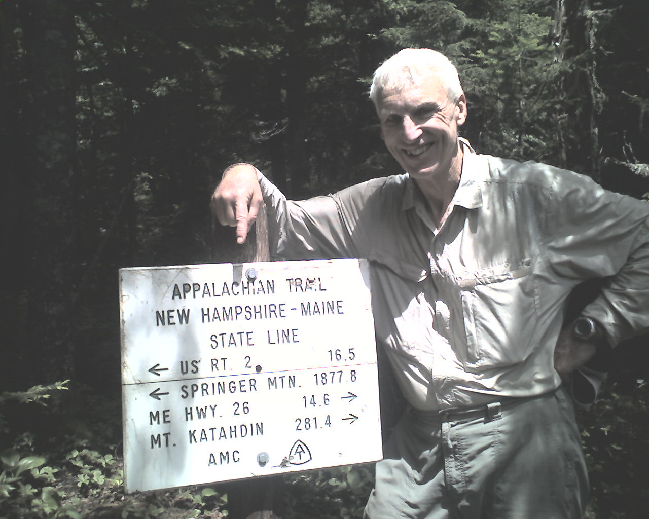
At 12:30pm Flaxseed and I crossed the Maine / New Hampshire state line. Today's photo features yours truly at the state line sign. We are happy to be out of Maine and looking forward to the challenge of New Hampshire's White Mountains, known to be the AT's toughest peaks.
We stopped for lunch in a sunny spot just past the state line and spread all our wet gear and clothing out to dry. It was dry in 30 minutes. What a joy to see the sun and feel its therapeutic and spirit lifting rays.
At 4:00pm we saw a big moose skeleton on the side of the trail; a big skeleton with big jaw bones and rib bones.
At 5:30pm we arrived at Gentian Pond Shelter which we are sharing tonight with Cold Feet, The Wizard and Spinmaster.
Today's walk took us from Full Goose Shelter tentsite, trail mile 276.5 to Gentian Pond Shelter, trail mile 286.1, a total of 9.6 tough miles in 11 hours for the day.
Many of God's richest blessings to all of you.
 Friday, July 10, 2009
First Trail Magic
Location For The Night: Royalty Inn, Gorham, NH
Miles Walked Today: 11.70
Day Number:
23
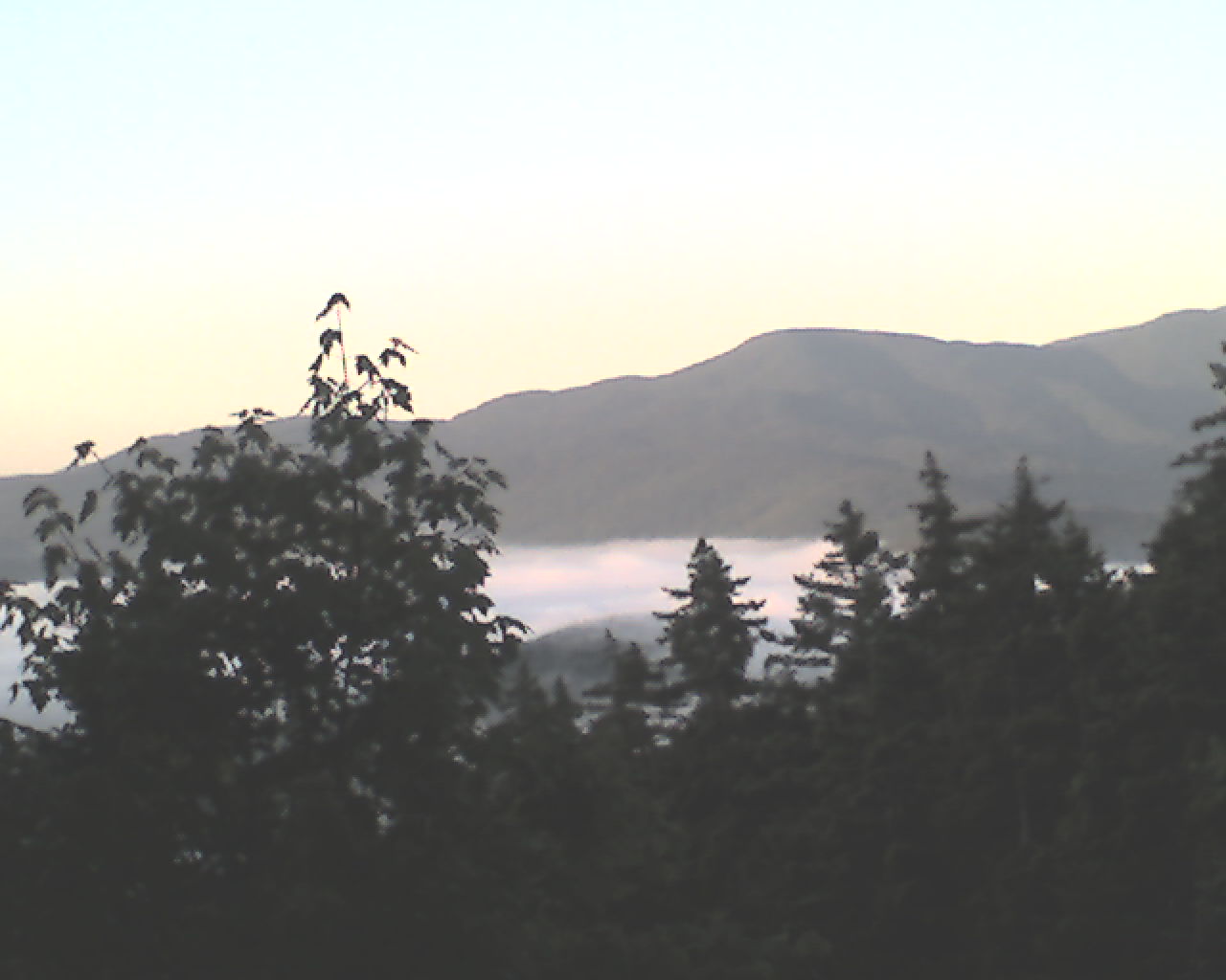
At 4:30am I peaked over the top of Spinmaster who was bagged up between Flaxseed and me to see if Flaxseed was awake. He was not. At 5:10am we made eye contact and nodded to each other. It was time to pack. Silently, as not to disturb our bunkmates, we gathered our gear, retrieved our food bags from the solid steel, double locked bear box (we are in black bear country now) and departed at 5:40am. The sun was shining and it was in the upper 40s. Today's photo is the view from the shelter that we awakened to this morning.
Today's walk was comparatively easy. We passed several lakes and ponds and climbed two small mountains, Cascade Mountain and Mt. Hayes ( I wondered if it was named for President Rutherford B. as the Presidential range looms ahead.).
At 1:30pm we were treated to our first trail magic of the journey. A trail angel (trail angels produce trail magic) blessed us with Pepsis and Little Debbie chocolate rolls in a box beside the trail. Thanks trail angel. Your treats hit the spot.
At 1:54pm we crossed the raging Androscoggin River on a highway bridge. The bridge is next to a hydroelectric dam but the majority of the hydraulic energy was being released through an overflow flume, not through the turbine outflow. It's been raining a lot up here you know.
At 2:00pm we reached US Highway 2 near Gorham, NH, stuck out our thumbs, and at 2:25pm Cynthia Gralenski, a local lady picked us up for the ride into Gorham. Thanks Cynthia.
Because of some confusion on my schedule (caused by old age I guess) we checked in at The Barn, a local hostel, to see if I had a drop box there. I did not. My next boxes are about 22 miles south at Pinkham Notch. This was confirmed by Annie at the Visitor's Center there. Thanks Annie. A hiker's drop boxes are his life blood.
We made a reservation at the Royalty Inn, crossed the street to the Chevron station and, at 2:23pm, got a ride to the motel with Lindsay, Hutmaster at Carter Notch Hut in the Whites, the first hut we will visit going south. She assured us of good food there. I showed her my ring trick.
At 3:00pm we checked in the motel, had milkshakes, took showers, did laundry, and ate supper. Now, it's 8:22pm and Flaxseed is gently snoring. Time for me to sign off.
Today we walked from Gentian Pond Shelter, trail mile 286.1 to US Highway 2, Gorham, NH, trail mile 297.8, a total of 11.7 miles for the day.
May the Lord of Heaven bless you with abundance.
 Saturday, July 11, 2009
Dry Shoes
Location For The Night: Carter Notch Hut
Miles Walked Today: 15.20
Day Number:
24
The Royalty Inn treated us like royalty. We had a quiet room away from the highway. We slept with the window open. It's still cool up here. Even in the valleys (notches) it has been cool. At 6:30am we were eating breakfast in a restaurant not far from the motel. I had two eggs, three pieces of bacon, three big pancakes and a waffle. Calorie intake is very important to a through hiker.
After breakfast we stood beside the highway hitching a ride back to the trail. At 7:30am Matt Tassey of Portland, Maine, picked us up. Matt and his wife were raised near Gorham and own a weekend home here. Thanks Matt.
At 7:45am we were walking. In the White Mountains of New Hampshire. Yesterday's walk was the last of the Mahoosuc range. Today we climbed Mt. Moriah (4,049'), Middle Carter Mountain (4,600') and Carter Dome (4,832). Hard climbs, but, praise God, the rocks were dry. One could actually feel one's soles grip the surface of the rocks. And, praise God, today was the first day since we started on June 18, that our feet were dry. Dry feet. All day. Hallelujah.
At 2:32pm we had a great view of the antennas on top of Mt. Washington. It's getting closer and closer.
At 4:30pm we ran into a group of day hikers returning down the mountain. They offered and we accepted a bag of Milano cookies - trail magic.
At 6:30pm we arrived at Carter Notch Hut, the northern most of the staffed White Mountain Huts. These huts cater to high paying overnight guests. We through hikers do what is called "work for stay". We get plenty of leftovers from the meal, and I mean plenty, and we sleep on the floor of the dining room. The paying guests are in separate bunkhouses. A good deal as it's raining again tonight. Tonight's meal was bow tie pasta, mashed potatoes, cranberry sauce, mixed vegetables, turkey and gravy, homemade tomato soup and all the chocolate cake we could eat. Flax and I washed the dishes tonight so we can leave early in the morning.
All the other through hikers here with us are NOBOS. I would give you their trail names but most are already asleep as I type. There are about 10 of us here in the dining room but it does not seem crowded and I've got my ear plugs ready. Oh, by the way, Lindsay, the young lady that took us to the motel yesterday, is here. And she is the boss, the Hutmaster.
Today we walked from US Highway 2, Gorham, NH, trail mile 297.8 to Carter Notch Hut, trail mile 313.0, a total of 15.2 miles for the day.
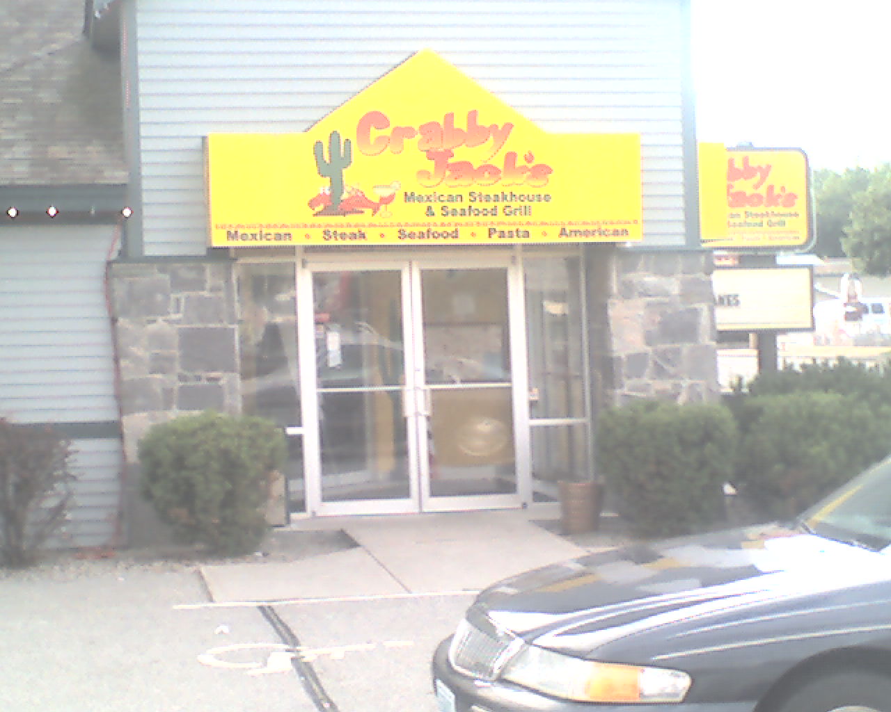
I know it's not much but today's photo is of Crabby Jack's restaurant in Gorham where we ate supper last night.
May God bless you with the peace that is only available through His Son, our Lord and Savior, Jesus Christ.
 Sunday, July 12, 2009
Bear In Camp
Location For The Night: Osgood Tent Site
Miles Walked Today: 10.70
Day Number:
25
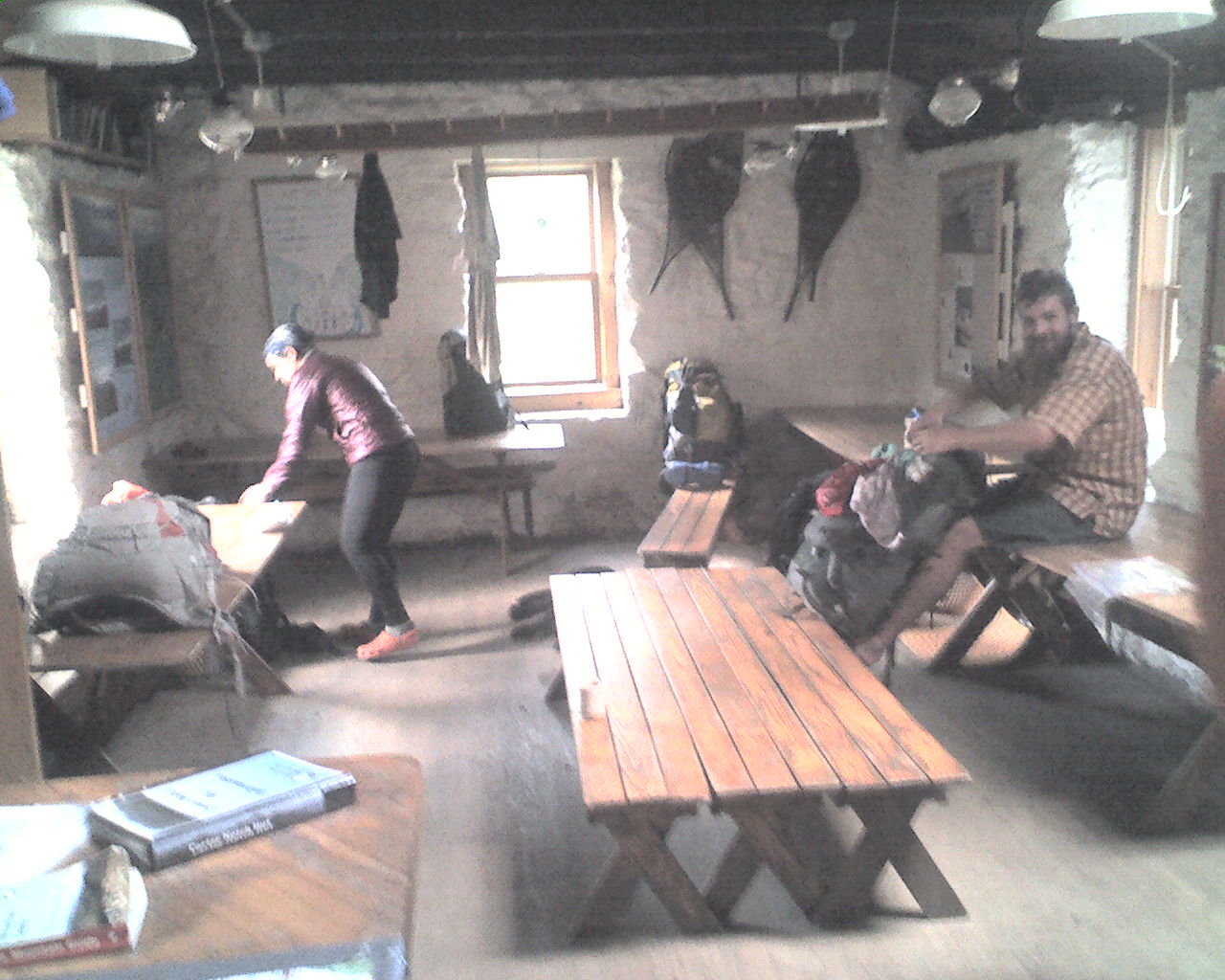
Carter Notch was a great place to be last night as it was rainy and windy most of the night. Fortunately the morning dawned clear and Flax and I were on our way at 6:45am. Lindsay and her crew (spelled croo at all the White Mountain huts) treated us with the greatest hospitality. A big thanks to all of you. Today's photo is the hut dining room as we through hikers were cleaning up this morning after sleeping on the floor, on benches, and on tables.
At 10:15am we reached the top of Wildcat Mountain peak D where a ski lift gondola was shuttling folks up and down. This is a much easier way to ascend and descend than what we do all day long.
We then made the long, steep, rocky descent to the Pinkham Notch Visitor's Center run by the Appalachian Mountain Club (AMC). We arrived at 1:30pm.
I had three boxes waiting at the center; my regular resupply box (mostly food), my bounce box (a box with items needing replacement or replenishment every 300 miles or so), and a new pair of sneakers to replace the worn out pair I've been wearing. We ate a bad, high priced lunch at the center (stale sandwiches with tiny portions of meat), I packed my gear, bounced my bounce box (by US Mail) another 300 miles south and we were walking again at 3:00pm.
The next 3 mile section of Madison Gulf Trail, an AMC trail that the AT shares, had no white blazes. We, as many AT hikers would be, were frustrated and confused a good part of the late afternoon. Here's my question for the AMC. Why not use a little white paint to help reassure AT hikers?
At 6:30pm we arrived at Osgood Tent Site. Campers there before we arrived had seen a black bear in camp. And sure enough, as Flax was eating and I was pitching my tent, a young, approximately 190 pound, bear came right up to our campsite, not once, but three times. Each time we chased it away by waving our arms, yelling, and throwing rocks. Later, two "peak" climbers that had camped here last night returned to camp only to have Blackie bother them for a second night. They yelled and clapped their hands. This bear wanted no part of us. He only wants our food. Rest assured it is hung about 20' high tonight.
Later, at 8:10pm, the same two peak climbers came jogging down the path from their campsite to ours. A she moose had entered their camp and they were giving her time to depart before returning. Lots of action in camp tonight.
Today Flax and I walked from Carter Notch Hut, trail mile 313.1 to Osgood Tent Site, trail mile 323.8, a total of 10.7 miles for the day.
God bless each of you.
 Monday, July 13, 2009
Mount Washington
Location For The Night: Lake of the Clouds Hut
Miles Walked Today: 10.10
Day Number:
26
We had no bear problems during the night. As I said yesterday, the bear only wants our food. When we are careful to store it out of our shelters and out of his reach we are seldom bothered. By the way, I learned this at Philmont, not on the AT.
Flaxseed and I were stirring at 3:50am. We had two big climbs ahead of us today and needed an early start. After packing my gear I made a trip to the sanitary facility (privy) provided at most shelters and recognized campsites. Flax said he would finish packing and meet me shortly. On his way to meet me, headlamp still on, he ran smack dab into last night's she moose. Flax said, "Ringmaster, she just froze. I guess it was the headlamp. I was so close to her I could've kissed her."
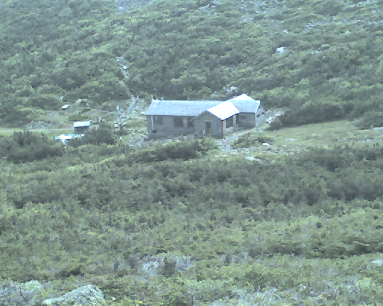
We started walking at 4:50am. Our first peak was Mt. Madison (5,366'). As we climbed higher the wind increased to probably 60 miles per hour. It's hard to stand up, much less keep moving forward over boulders. We made the summit and by 8:30am we had descended to Madison Spring Hut (today's photo). The "croo"; Hillary, Maddie, Keith and Andrew offered us pancakes and hot coffee left over from breakfast and we readily accepted. We departed warm and full. Thanks guys.
Now it was time to climb Mt. Washington (6,288'), the granddaddy of the White Mountain peaks. The weather was partly sunny for the first half of the climb and the views of the surrounding mountains and the valleys below were expanded as we climbed higher. Then, at 1:00pm, the sky started to blacken and a light, wind driven rain began. Before long the rain changed to horizontal pellet size hail. In the 60-70 MPH wind it felt like ice cold shotgun pellets. I ducked behind a rock to store my PDA and put my pack cover on. Flaxseed was somewhere in front of me. As the hail continued and started to accumulate on the trail I resumed hiking. Visibility was about 50'. I wanted to catch Flax. After walking about 400 yards I saw his pack on the ground propped against a rock. He had left it there so I would know where he was. I called his name. He yelled, "Ringmaster, over here," and crawled up out of a hole.
Here's what happened. As the hail intensified Flax ran into Joe Cormier, 27, a local New Hampshire hiker who knew the trail. They ducked into a small cave together. I ducked in too and there was just enough room for the three of us. We squatted in the cave for about 20 minutes until the storm was over. Thanks Joe and thank You Lord.
We resumed our climb and at 1:55pm we met Jared Woodcock working on his master's thesis in biology. He is studying pipits (birds) and, dressed in camo, was trying to capture one in a portable net. He said his net was faulty and ran on up the trail.
At 2:20pm we reached the top of Mt. Washington. A road and a cog railway run to the top of the mountain. The Summit House restaurant and gift shop are very busy. It reminds one of a slope side restaurant at a ski resort. We ate a lot of high fat, greasy food and hiked on own the mountain another 1.4 miles to the Lake of the Clouds Hut. We are housed in "The Dungeon" or unfinished basement tonight. All the paying guests and "work for stay" hikers are upstairs. There is a propane powered generator running outside our abode as I complete this report and sign off at 8:15pm.
Today we walked from Osgood Tent Site, trail mile 323.8 to Lake of the Clouds Hut, trail mile 333.9, a total of 10.1 miles for the day.
May God's richest blessings bless you and you family.
 Tuesday, July 14, 2009
Hut Food
Location For The Night: Ethan Pond Campsite
Miles Walked Today: 14.00
Day Number:
27
The weather on top of Mt. Washington is known to be the worst in the U.S. and Lake of the Clouds Hut is just below the summit. The wind blew hard all night and it was 35 degrees and foggy this morning. We heard later that the low temperature tied the record for the date.
Flaxseed and I slept in until the paying customers had finished their breakfast. At 8:00am we went upstairs and worked a deal for leftovers. Bryan, the Hutmaster, asked us to sweep the dining room floor in exchange for breakfast. I swept while Flax ate. Then I ate. We ate large quantities of cheesy scrambled eggs with green peppers and onions, oatmeal and gooey cinnamon rolls. And lots of hot coffee. All the bacon was gone.
By 9:00am we were walking. We climbed Mt. Pierce (4,310') in a biting wind and descended to Mizpah Spring Hut, arriving at noon. There we each had two bowls of bean soup, several brownies and some fudge, all homemade at the hut.
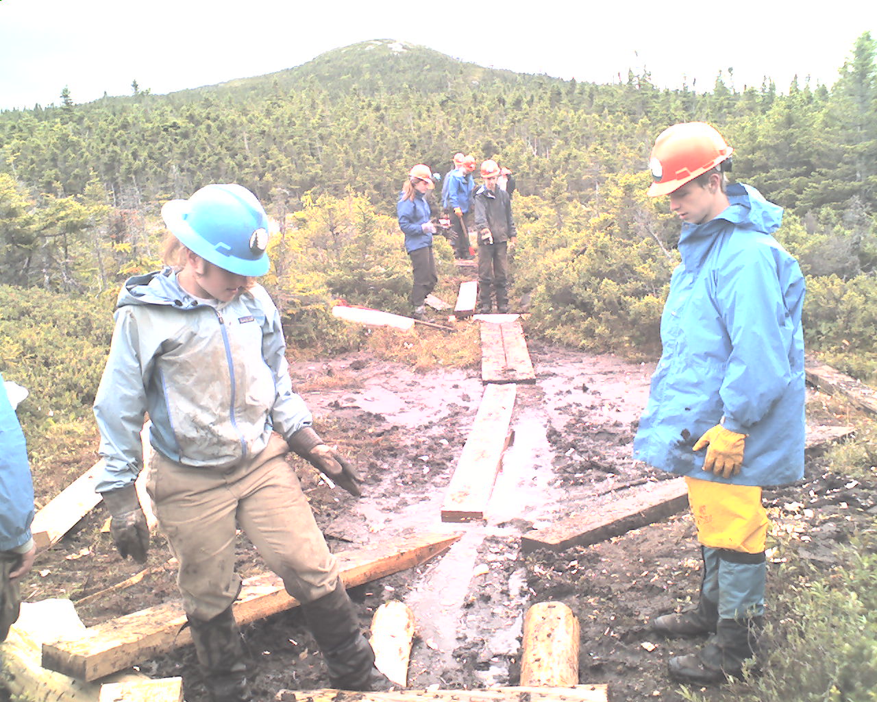
We climbed Mt. Jackson (4,052') and Mt. Webster (3,910'). The weather improved to mostly cloudy. At 1:00pm we encountered an AMC volunteer trail crew working on new bog bridges. Today's photo features that crew.
At 5:00pm we reached US Highway 302 and debated going into town but decided to keep going another 2.9 miles to Ethan Pond Campsite. We pitched our tents here.
Today we walked from Lake of the Clouds Hut, trail mile 333.9, to Ethan Pond Campsite, trail mile 347.9, a total of 14.0 miles for the day.
God bless you all.
 Wednesday, July 15, 2009
Spruce Grouse
Location For The Night: Garfield Ridge Campsite
Miles Walked Today: 14.50
Day Number:
28
It was cool again last night and we had light rain, enough to dampen our tents. The morning dawned clear and cool, a perfect day. We were up and on the trail at 5:35am today with hot breakfast on the agenda. Zeland Falls Hut was only 4.8 miles south and we were timing our walk to arrive
for leftovers.
It was an easy walk that, for the most part, followed an old logging road. At the end there was a steep climb up to the hut and we arrived at 7:35am.
The paying guests ($175.00 each per night we are told.) were finished with breakfast and enjoying the sunshine before resuming their day hikes, many of which follow graded trails that are shorter and easier than the AT. A typical "Hut" vacation involves day hiking from hut to hut to hut on the easy trails.
We spread out our gear to dry in the sunshine and I asked the Hutmaster what we could do to earn our board. He said sweep the floor. We swept and in exchange received oatmeal with brown sugar and pancakes and syrup; all we could eat. Four young NOBOS ate with us. We were walking again at 9:00am.
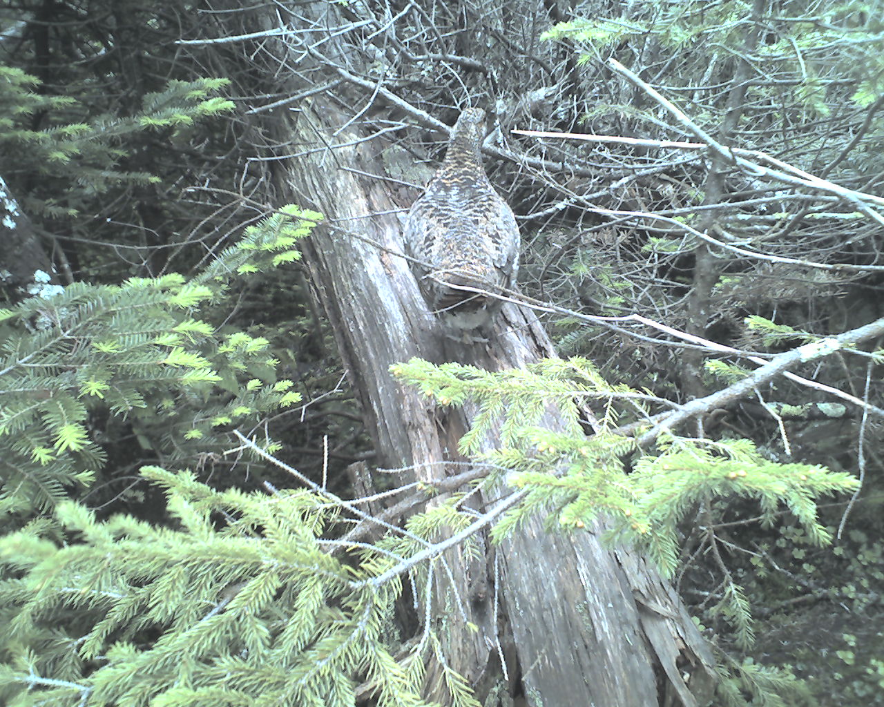
At 10:35am we came upon a Spruce Grouse with three chicks, right in the middle of the trail. She did not seem alarmed when she saw us and did not fly. Today's photo is the mama grouse on a fallen tree next to the trail. I apologize for the quality of these cell phone photos. But, as I told Flaxseed today, if one wants to see a quality picture of, say, Mount Washington, all one need do is type in Mt. Washington on Google Images and one will be inundated with the same. You might try this to enhance your vicarious experience.
At 12:16pm we encountered section hiker, Dancing Bear, 58, of Charlotte, NC. He said he owns a vacation home near Roan Mountain on the AT and then lit into a lengthy tirade about problems with a real estate deal gone sour and how he was trying to get assets out of his name and into his kids names and how the lawyers and creditors were after him and on and on. As we said our good-byes I thanked the Lord and my family and my business partners for allowing me to do this without that kind of stuff on my mind. I mean it guys. Thanks.
Then, at 2:00pm, it was hut number two for the day, Galehead Hut. Lunch time. We each had three bowls of chicken vegetable soup. When it ran out the crewmember heated up potato soup. I had one bowl; Flax two.
At 5:00pm we arrived at Garfield Ridge Shelter and Campsite and checked in with Matt, the caretaker. At campsites with caretakers the AMC charges $8.00 per person to camp, but, as we were the first two through hikers to arrive tonight, Matt waived the fee. Thanks Matt.
We pitched our tents on a wooden platform provided at the campsite. I cooked corn grits. Flax, who does not cook on the trail, had peanut butter on tortillas and chicken breast on tortillas.
Today we walked from Eathan Pond Campsite, trail mile 347.9 to Garfield Ridge Campsite, trail mile 362.4, a total of 14.5 miles for the day.
May God bless you with His peace, a peace that is only available through His only Son, the Lord Jesus Christ.
|