 Thursday, July 16, 2009
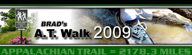
Franconia Ridge
Location For The Night: Carriage Motel, North Woodstock, NH
Miles Walked Today: 10.20
Day Number:
29
No hikers were stirring as Flaxseed and I began packing up at 4:30am and started walking at 5:15am. It's like that most mornings. We like to get an early start and, as is the norm on a "town day", we had an added incentive.
The climb up Mt. Garfield (4,488') was immediate and steep, but only took an hour. Next was a steep descent, then the much longer climb up Mt. Lafayette (5,249'), the second most popular mountain in the Presidentials, though the French general was never a president.
On the way up we stopped for breakfast behind a big rock to shield ourselves from the wind. As we ate, at 8:28am, we were treated to a delightful rainbow, a promise from the Lord.
The wind increased as we reached the summit, but the views were magnificent in every direction. None of the big peaks were covered in clouds. Mt. Washington looked as far away to the north as it did 10 days ago to the south. Today's views were magnificent, a veritable testimony of God's creative power.
At 9:15am we reached the summit of Mt. Lafayette. It was covered with day hikers that had hiked up from Greenleaf Hut, 1.1 miles off the AT, down a steep trail. Needless to say, we did not visit this off trail hut, even for breakfast leftovers. Our job is to follow the white blazes, not take side trips.
Next was Franconia Ridge (today's photo shows a part of this ridge), almost two miles of exposed ridge above treeline that includes the summits of Mt. Lincoln (5,089') and Little Haystack Mountain (4,760'). The wind and the views continued and it was wonderful. I told my buddy Flax, "Never in my wildest imaginations did I think I would be so blessed as to be in a place like this." He concurred.
At 10:40am as we came to the end of the ridge and were about to drop back into the forest I called Fran at The Carriage Motel in North Woodstock, NH, and reserved a room for the night. (We always ask for both the through hiker rate and the senior discount. Most times it works. Saved $7.00 today.)
At 1:40pm, after the obligatory steep, rocky descent, we arrived at U.S. Highway 3. We called Mandy at the local shuttle service number (listed in the guide book) and she was there to pick us up in 10 minutes. Then the race began.
The "race" in a trail town entails working together to coordinate all the trail town chores as quickly and efficiently as possible, and, by so doing, leave more time for eating and sleeping. We're getting pretty good at it too. We've bathed, done laundry, resupplied, eaten two greasy, high fat, high calorie meals and, at 7:30pm, Flaxseed, the rascal, is already asleep. I will be soon.
Today we walked from Garfield Ridge Campsite, trail mile 362.4 to U.S. Highway 3, North Woodstock, NH, trail mile 372.6, a total of 10.2 miles for the day.
May God bless each of you.
 Friday, July 17, 2009
Town Again
Location For The Night: Carriage Motel, North Woodstock, NH
Miles Walked Today: 16.40
Day Number:
30
Before typing today's report I want to tell you how Flaxseed and I define a "through hike." For both of us a through hike of the AT is: Walking the white blazed trail from one end to the other in the same direction (this time that means heading south) while carrying all our gear. That is what we do each and every day we walk.
But, some that call themselves "through hikers" do it differently and there are no hard and fast rules. Many hike on "blue blaze" trails to reduce both distance and difficulty. "Blue blazing" cuts out many miles and many vertical feet. Others will "slack pack." A slack packer day hikes with a day pack, leaving most of his gear behind. Normally he is dropped at one road or highway that the trail crosses and picked up at the next. Then he is shuttled back to a hostel or motel for the night. Many hostels provide slack packing shuttles (for a fee of course) and it is possible to stay at one hostel for a week or more, slack packing a different section of trail every day, sometimes going north, other times going south.
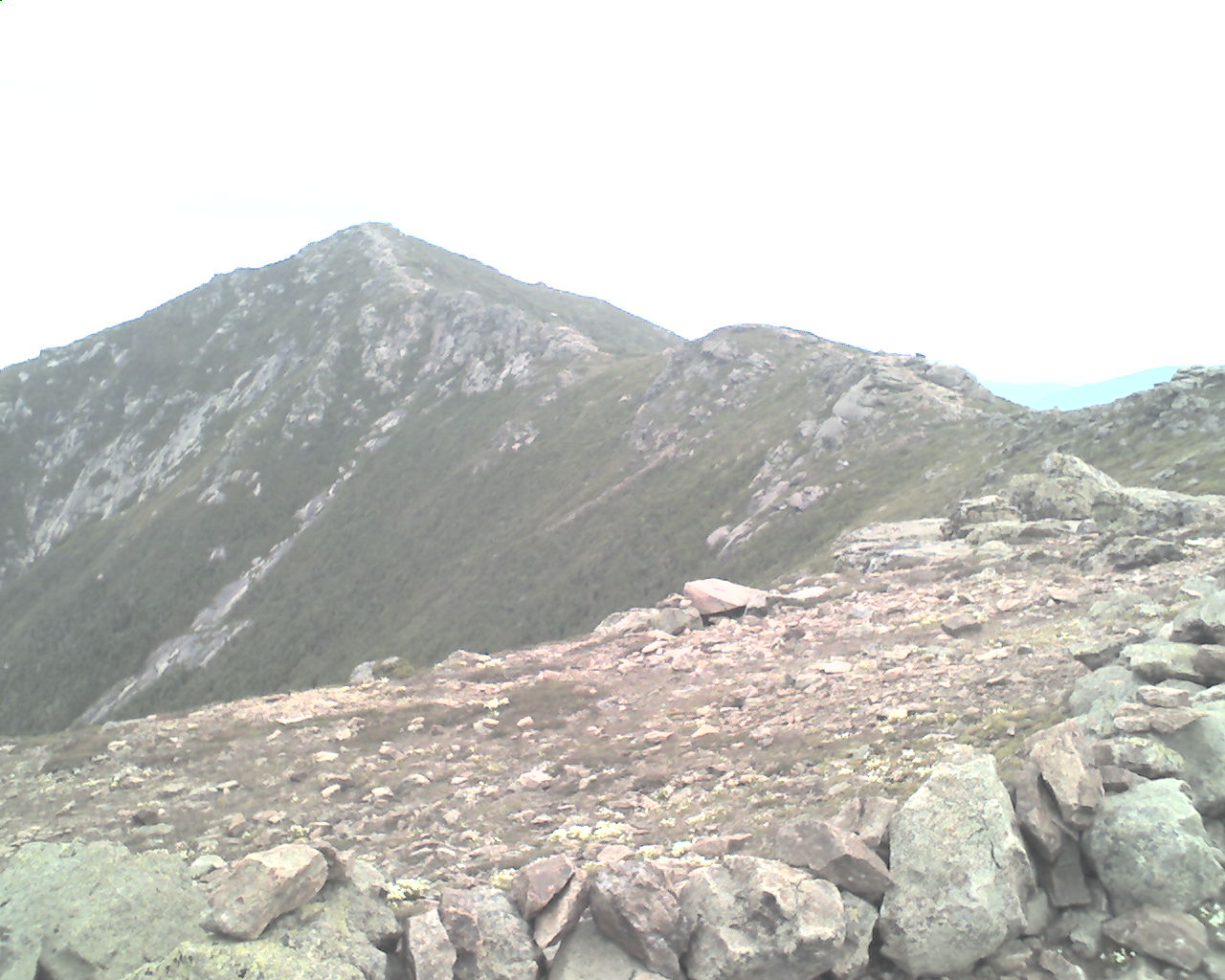
Now for today's report. We were up at 5:00am and left the motel at 5:30am, fully packed with four days of provisions. We had a good, big breakfast at Peg's restaurant (today's photo)where Christie was our waitress. The shuttle driver picked us up at 6:40am and we were walking at 7:00am.
The weather this morning and early afternoon was the best we have had. Sunny, clear and warm. We summited North Kinsman Mountain (4,293') and South Kinsman Mountain (4,358'). Then it was down to Eliza Brook Shelter where we ate lunch at 1:00pm. As we walked on into the afternoon two things became obvious. One, we were going to reach NH Highway 112, Kinsman Notch, at about 6:30pm and, two, it was starting to rain. So, at 4:00pm I made a second night's reservation at The Carriage Motel in North Woodstock, NH, and called the same shuttle service for a ride into town. At 6:11pm we walked off the trail at the highway and our ride was there in ten minutes.
We checked into the motel and showered, washing our hiking clothes in the shower as we bathed. There was no need to resupply or do major laundry as we had done that yesterday.
We ate supper at the Landmark II restaurant. I had steak, baked potato and salad. Flax had liver and onions, baked potato and salad. Good meal. Then we walked to an ice cream stand for triple scoop cups. Now Flaxseed is sleeping and I'm ready to join him. It is raining.
Today we walked from U.S. Highway 3, North Woodstock, NH, trail mile 372.6 to NH Highway 112, North Woodstock, NH, trail mile 389.0, a total of 16.4 miles for the day. And, though we are in the same motel in the same town as last night, we did not slack pack.
May God bless all of you.
 Saturday, July 18, 2009
Goodbye Whites
Location For The Night: Ore Hill Shelter
Miles Walked Today: 17.00
Day Number:
31
We made a good decision yesterday afternoon. It rained most of the night. When this happens we feel logistically superior. We recline in bed, watch the Weather Channel, and smugly tell each other how happy we are to be here and not in our tents.
It was still raining at 4:30am so we slept in until 6:00am. Then we repeated yesterday morning. We walked down the street to Peg's restaurant and Christie served us each a Hungry Man breakfast, just like yesterday. We called the shuttle, he was there before we finished eating, and had us back on the trail at 7:50am. By then the rain had stopped.
We immediately attacked Mt. Moosilauke (moose-ah-lock) (4,802'), the southernmost of White Mountains' big peaks. We reached the top at 10:50am. Moosilauke is the last of the Whites. The climb was 3,000' of vertical and the descent was 3,700' of vertical. Descents are harder on our old legs than climbs. The kids bounce down the mountains. We proceed downhill slowly and carefully.
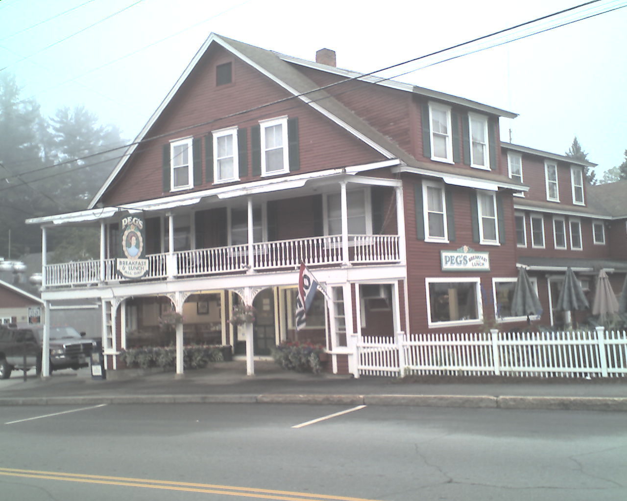
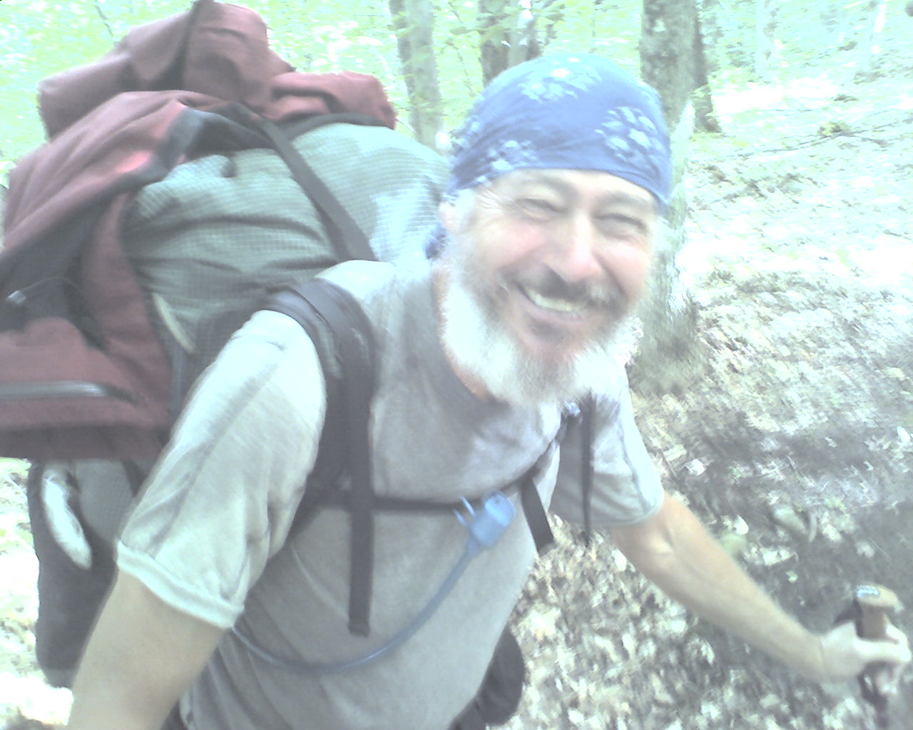
At 1:25pm we stopped at Jeffers Brook Shelter to eat lunch. Scoutmaster, Dave, and Troop Committee Chairman, Steve, of Troop 33 from Sun Prairie, Wisconsin, had a group of about ten older scouts (four Eagles) up here for a week of backpacking. I dumbfounded them with my ring trick and told them how I'd worn out everyone in the chow line at Camp Manchester by showing it over and over. Today's photo is Flaxseed packing up after lunch.
(By the way, a Paducah physician sent me an email asking me to explain "the ring trick." It's a a slight-of-hand trick that involves a small looped chain and a steel or brass ring, but it's hard to explain; you would need to see it in person. However, there are several physicians at the Internal Medicine Group in Paducah that are also Troop 1 dads and leaders. I will not name them here, but maybe you can get in touch with them and find out more about "the ring trick.")
After lunch we continued on, now at much lower elevations. It was sunny, hot and muggy. Goodbye alpine zone. We ended up the day in our tents at a semi-stealth site about 200 yards from Ore Hill Shelter. The mosquitoes are thick. We are happy to have tents with bug netting.
Today we walked from NH Highway 112, Kinsman Notch, trail mile 389.0 to Ore Hill Shelter, trail mile 406.0, a total of 17.0 miles for the day.
Many, many blessings to you all.
 Sunday, July 19, 2009
Tuckered Out
Location For The Night: Holts Ledge - Stealth Camp
Miles Walked Today: 19.60
Day Number:
32
Today Flax and were moving at 4:45am and on the trail at 5:30am. The sky was clear and it was pleasantly cool; probably 60 degrees.
We are out of the White Mountains but the terrain is not easy. Less strenuous maybe, but not easy. It will still wear you out, as it has done today. We are tuckered.
Here is a rundown on the elevation changes today. We left camp at 1,720' and descended to 900'. Next was a climb of over 2,000' to the top of Mt. Cube, from 900' to 2,911'. Then we descended to 1,450' and climbed back up to 3,220', almost 1800' of vertical. We finished the day by descending to 880' and climbing back up to 2,100' to our night's campsite, over 1,200' of vertical. This is a typical day on the Appalachian Trail. Up and down and up and down. If there is a hill anywhere to be found the AT will find it.
Otherwise today was pretty quite. The weather was good. There is still a lot of mud, but it is starting to dry. We heard some wolves early this morning and saw some rock walls along the trail this afternoon. It appears that the rock walls are the result of clearing for logging roads years ago. The rocks were moved out of the roadway and stacked up along the side of it.
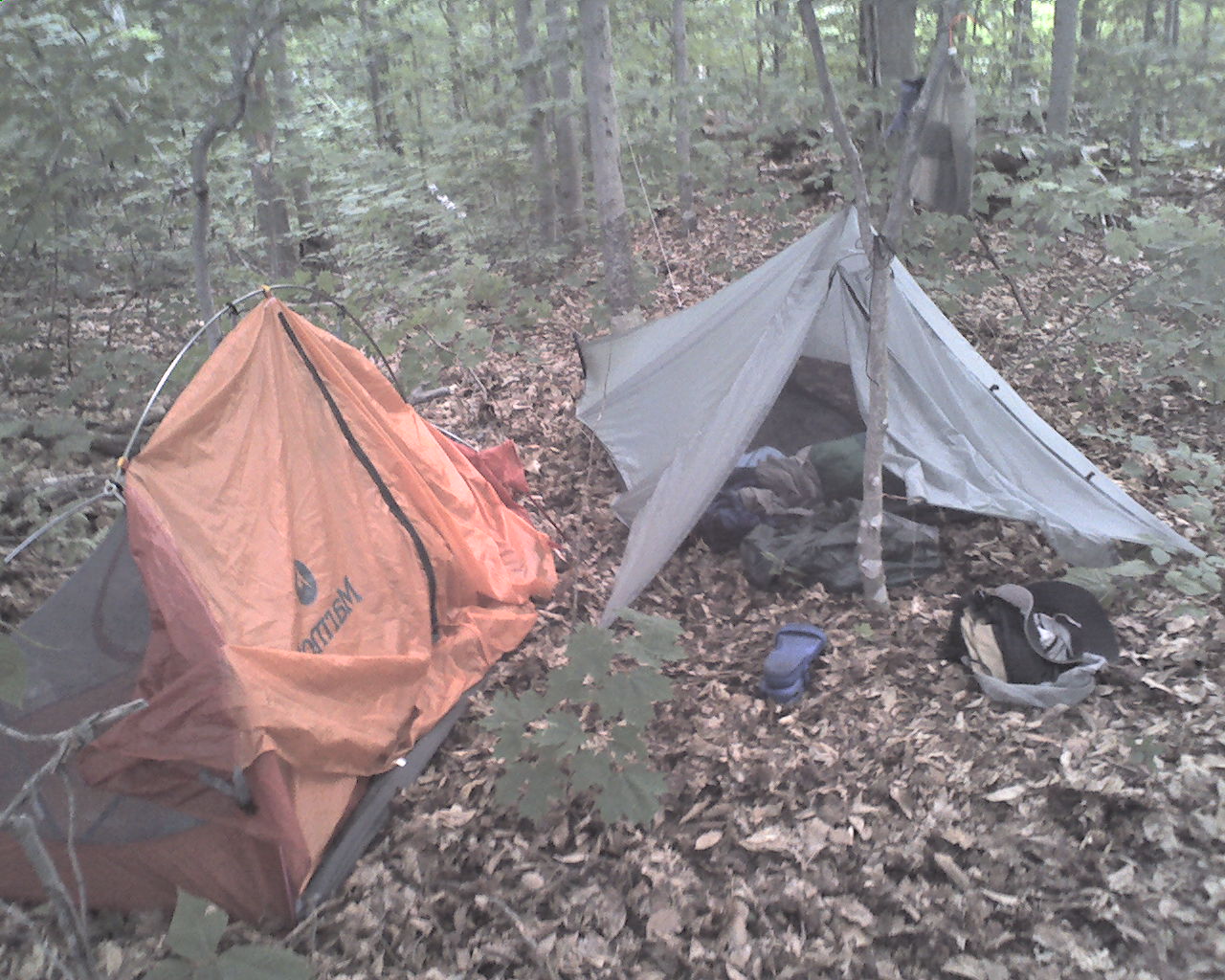
Today we walked from Ore Hill Shelter, trail mile 406.0 to a stealth camp on top of Holts Ledge, trail mile 425.6, a total of 19.6 miles for the day. Today's photo shows our shelters pitched at tonight's campsite.
May the Lord of Heaven bless you with His eternal love.
 Monday, July 20, 2009
The Ruin
Location For The Night: Sunset Motor Inn, Hanover, NH
Miles Walked Today: 17.00
Day Number:
33
Today we were on the trail at 5:15am. As we climbed to the top of Holts Ledge, a shear bluff, the sunrise and views over the mountains to the east were glorious.
We summitted Moose Mt. North peak at 7:30am and ate breakfast on top of Moose Mt. South peak at 8:40am.
At 9:30am on the way down Moose Mt. we encountered NOBO through hiker "The Ruin", 56, of Australia via Scotland. His accent had a touch of both countries. I showed him the ring trick and he exclaimed, "Magic, mate, absolute magic on the Appalachian Trail." His photo is featured today. He says he's grown his beard since he started in Georgia, but trims it once in a while to keep his whiskers out of his mouth.
A few minutes later The Ruin's hiking buddy, NOBO section hiker, "Hoosier Ben", 62, from Indiana met us. This year Hoosier Ben started at Harpers Ferry, WV. By the time he got to Delaware Water Gap, NJ, his wife asked him to come home. Ben said no. He told the Mrs., "I've got Katahdin in my sights and that's where I'm heading." Good luck Hoosier Ben, in more ways than one.
As we descended we were treated to lush, tall long needle pine forests, deep in pine needles and pine cones. Some were random growth trees, others were planted in rows.
At 1:00pm we met "Happy", another NOBO through hiker. Happy spent last night in Hanover, NH, and shared valuable information about the town with us.
At 1:45pm we walked onto the sidewalk in Hanover, NH, where the AT runs next to the campus of Dartmouth College and right down Main Street. We resupplied at the Co-op Grocery, walked downtown to the 5-Olde Nugget restaurant for big cheeseburgers, and caught the "free" city bus to the Sunset Motor Inn, two miles from downtown, where we are in residence for the night.
Tonight we plan to order-in at the motel and tomorrow morning we will catch the free bus at 6:25am, return to downtown Hanover, and resume our walk south.
Today we walked from Holts Ledge, trail mile 425.6 to downtown Hanover, NH, trail mile 442.6, a total of 17.0 miles for the day.
May God bless all of you.
 Tuesday, July 21, 2009
Hello Vermont
Location For The Night: Shire Motel, Woodstock, VT
Miles Walked Today: 22.40
Day Number:
34
I had two thoughts from yesterday that I failed to share. First, author Bill Bryson was living in Hanover, NH, when he attempted to hike the AT and then wrote "A Walk in the Woods", his hilarious account of the attempt. Second, yesterday the 77 year owner of the Sunset Motel (I did not get his name.) dubbed Flaxseed and me "reprobates", one of my late dad's favorite words.
Flax and I were up and waiting at the bus stop at 6:30am. The bus was on schedule and dropped us off in downtown Hanover where we left the trail yesterday. We had big breakfasts at Lou's restaurant and were on the trail at 7:10am
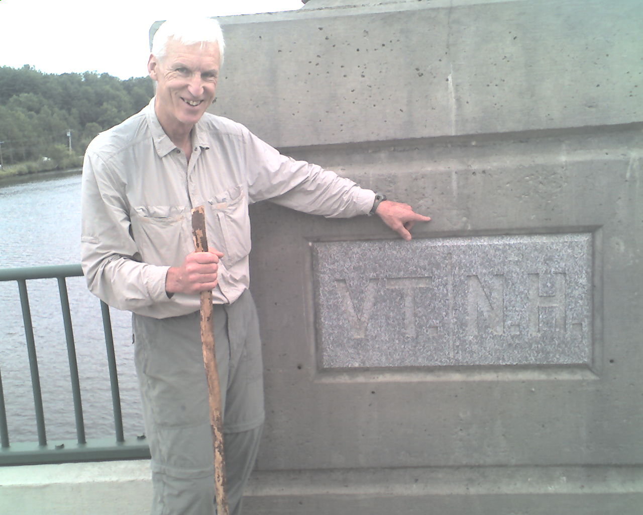
At 7:26am we crossed the Connecticut River and walked into Vermont. Today's photo verifies this event. Then we proceeded along the road into Norwich, VT. Norwich is pronounced Nor-ich up here. Finally the trail found it's way back into the woods.
At 8:20am we met NOBO flip-flopper, "Plugger", 68, of California. Plugger started at Harpers Ferry, WV, and is hiking north to Mt. Katahdin in Maine. Then he plans flip-flop by returning to Harpers Ferry and hiking south to Springer Mt. in Georgia. Plugger has a long white beard. One hiker told him he should change his trail name to Santa Claus. Plugger's advice for the day is, "Seize the moment; take it the way it is."
At 11:40am we road walked a short distance into West Hartford, VT, where we stopped for ice cream at the general store. Joining us there were SOBO through hikers Sugar Red and Burger King, two young, male identical twins. They are from Charlotte, NC. This is the second time we've seen and passed them, which means they got ahead of us somewhere along the way between passings. We call this leap-frogging.
Then something amazing happened. First, at 12:56pm, we met 357 Magnum. Then, at 4:47pm, we met Bliss, a 6th grade school teacher. The amazing thing is that Flaxseed met and hiked with both of them near the end of his 2007 through hike. Both of them immediately recognized Flax. He is, without a doubt, unforgettable.
It started raining at about 2:00pm and increased in intensity as the afternoon progressed. We had planned to camp, but the rain changed our plan. After all, we're on vacation. When we reached VT Highway 12 at 7:05pm we hitched a ride into Woodstock, VT, a classy tourist town, 4.4 miles east of the trail. The kind gentleman that picked us up was Kevin O'donnell. We found a room at the Shire Motel and settled in for the night. Supper was big salads from the grocery next to the motel. And, of course, ice cream.
Today we walked from Hanover, NH, trail mile 442.6 to VT Highway 12, trail mile 465.0, a total of 22.4 miles for the day.
May the blessings of the Lord be yours.
 Wednesday, July 22, 2009
Maple Syrup
Location For The Night: Mountain Meadows Lodge, Kent Pond, VT
Miles Walked Today: 18.90
Day Number:
35
The Shire Motel was swanky, the best lodging we've had to date. And, it was the cheapest place in town. This gives you an idea of what Woodstock, VT, is like. It too is very swanky.
Flaxseed and I awoke at 5:30am to check the weather; visually and on TV. It was to be a good day - no rain. At 6:45am we left the motel. At the house next door Robert Fenyk was outside enjoying the morning air. We asked for directions and a ride. Robert provided the former but said he could not help with the latter. We started walking with our thumbs out. A few minutes later a car pulled up beside us and stopped. It was Robert. He compassionately changed his mind and drove us back to the trail head, 4.4 miles west of town. Thanks Robert.
We were walking at 7:15am. The trail meandered through several hay fields and a cow pasture before finding its way back to the trail. We crossed several fences on stiles; the first of these we've seen this year.
As we ascended into the predominately maple forest of the Green Mountains of Vermont we observed the modern method of collecting sap to make maple syrup. No longer does each tree have a tap, spout and bucket, as I remember from pictures in grade school. Now, the same job is accomplished with a network of interconnected PVC pipes running from tree to tree up the mountain. Smaller piping at each tree (many are tapped several times) starts the network, then the pipe size increases and finally ends connected to a main line that transports the sap, via gravity, to a location unknown to me. I presume it goes to the Sap Collection Building.
We met quite a few NOBOs today but none of them stopped to talk. Two speedy SOBOs, Buffalo and Zombie, passed us in a run. They did not have time to talk much either, but they did tell us when they started at Katahdin. So, here's the thing. Buffalo started at Katahdin on June 8, and Zombie on June 10. Flax and I started on June 18. Could the old tortoise and hare story be relevant here?
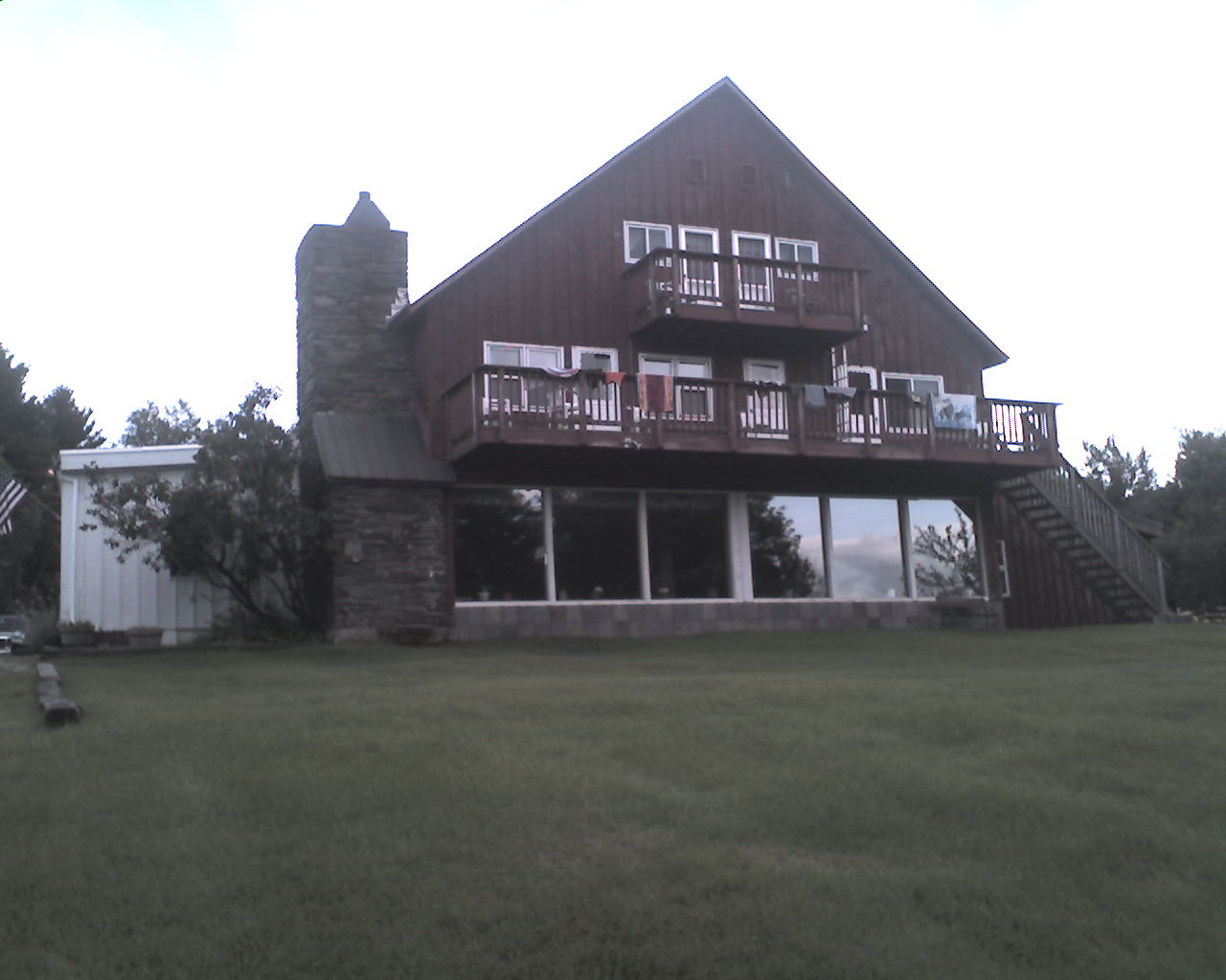
At 5:30pm Flaxseed and Ringmaster made another wise choice. We reserved a room at the Mountain Meadows Lodge (today's photo) located right on the trail at Kent Pond, VT.
At 6:15pm we checked into our room, showered, and joined the other guests for supper; lemon chicken breast with capers, tossed salad and ice cream cake; all we could eat. Scrumptious. Now, as is the norm, Mr. Flaxseed slumbers while I type and edit.
Today we walked from VT Highway 12, trail mile 465.0 to Kent Pond, trail mile 483.9, a total of 18.9 miles for the day.
God bless you all.
 Thursday, July 23, 2009
Kentucky Boy
Location For The Night: Clarendon Shelter - Stealth Camp
Miles Walked Today: 20.40
Day Number:
36
Breakfast (included in the room fee) at Mountain Meadows Lodge is served at 8:30am; too late for us. So, last night Bill, the owner, prepared a sack breakfast for each of us. We ate in the dining room and were walking at 6:45am.
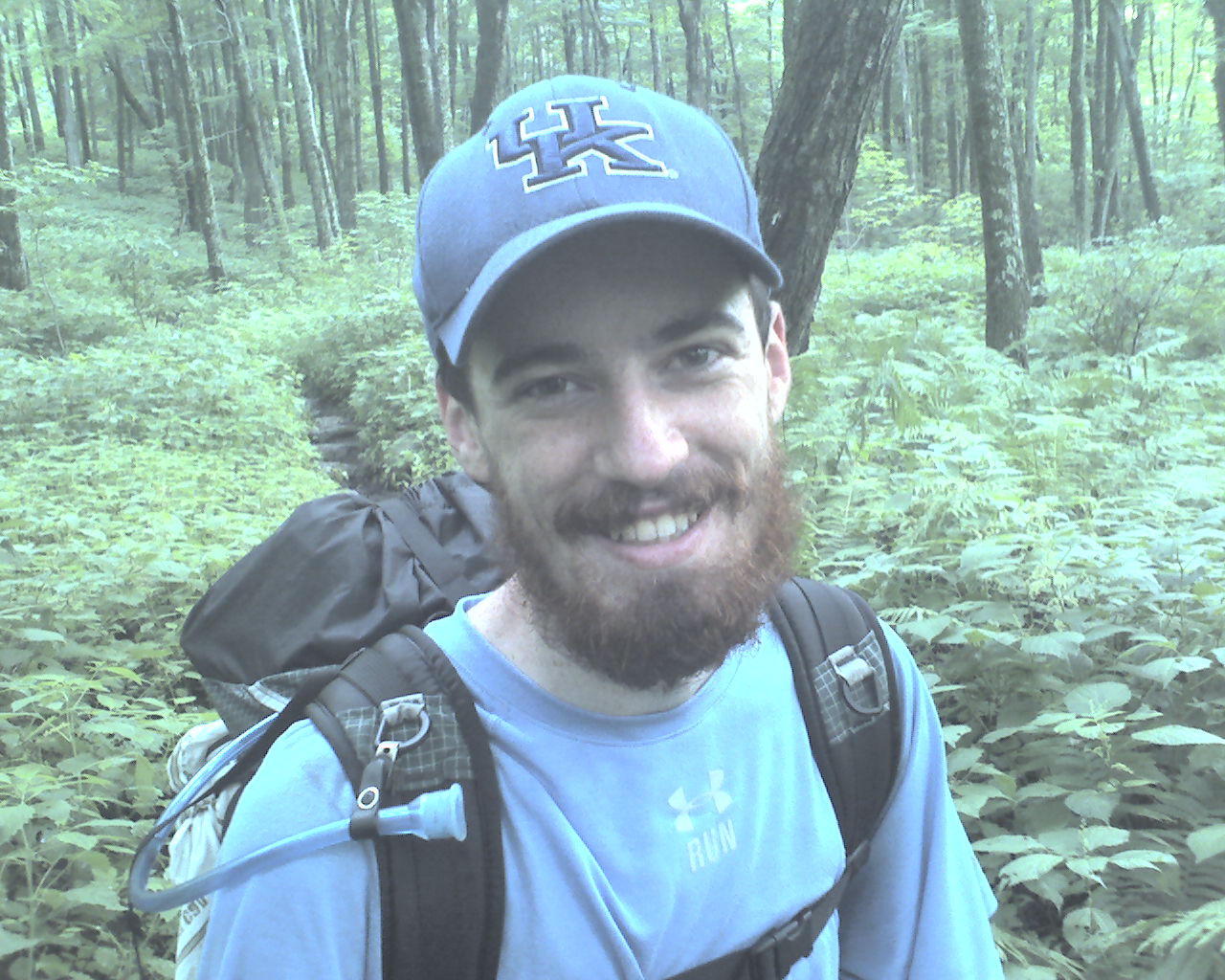
At 8:15am we met a young NOBO hiker. We exchanged greetings and kept walking. Then it clicked: That boy had a UK cap on. I turned around and shouted, "Hey, are you from Kentucky?" He shouted back, "Yeah, I'm from Bowling Green." His trail name is Whisp, and yes, he does spell it with an H. He recently graduated from UK with a degree in history and hasn't found a job yet so he's hiking the AT. I asked if he wanted to say anything to you folks reading this on the net and he said, "I'm good. Thanks."
At 9:05am we met NOBO section hiker, Retread, 58, from Anchorage, Alaska. Retread advises, "Have a good time."
As the day progressed we probably met at least another dozen NOBOs, but I didn't stop to talk to them.
I haven't said much lately about the astounding beauty of God's creation that we are blessed to be able to walk through each day. And I don't want you to think we take it for granted. The trees, streams, springs, wildflowers, ferns, and yes, even the rocks and the mud, are all a blessing from the Lord. Flax and I remind each other of this every day. Well, maybe not so much when it comes to the mud.
Today we walked from Kent Pond, trail mile 483.9, to a stealth camp near Clarendon Shelter, trail mile 504.3, a total of 20.4 miles for the day.
May God's unfailing love, available through His Son, the Lord Jesus Christ, be yours now and forever.
 Friday, July 24, 2009
Mouse In Camp
Location For The Night: Lost Pond Shelter
Miles Walked Today: 18.60
Day Number:
37
In the middle of the night it started to rain. When Flax heard the rain he retrieved his food bags from a branch he had hung them on. When he threw them in his tent a mouse "limped" out of one of them. Flax thinks he crippled it when he threw his food bag down. Crippled or not, it chewed holes in his food bag and ate some of his food. Tonight Flax tied his stinky hiking shirt around his food bag before hanging it. He thinks the odor from the shirt will deter any mice. We shall see.
Because it was raining we slept in a little later than usual and ate breakfast in our tents. We were walking at 7:00am.
There is still a lot of ankle deep mud on the trail. It makes it very difficult to walk and our feet stay wet most of the time. I'm sure you are aware that the Northeast is having one of its wettest summers ever and we are walking right through it.
Since yesterday morning we have been walking on both the AT and on Vermont's Long Trail. The Long Trail is older than the AT.
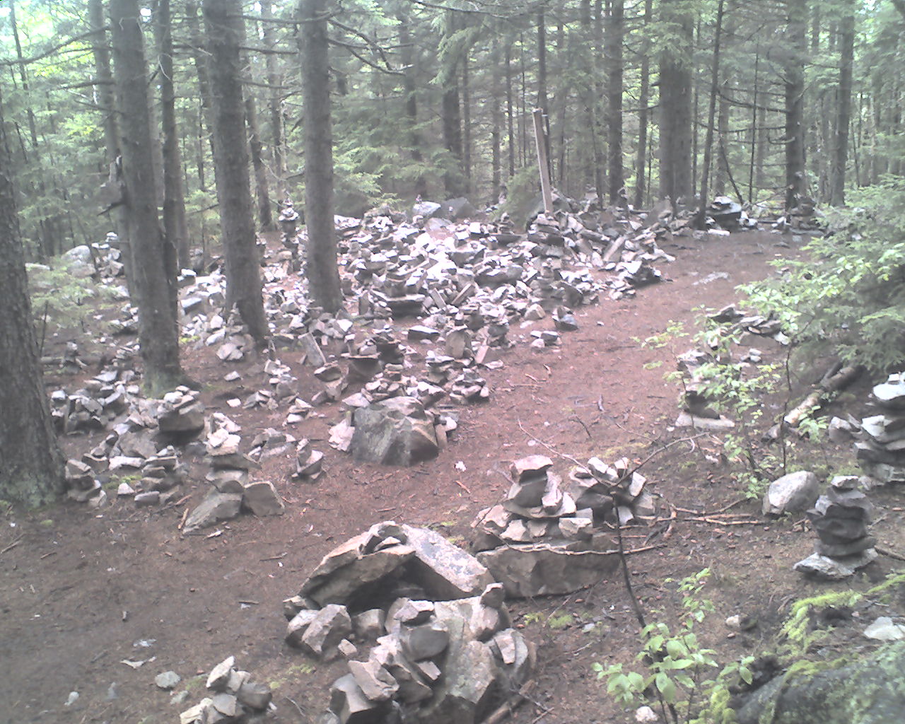
At 12:00 noon at the intersection to the trail to White Rock Cliff we were treated to what looked like a cairn graveyard; a jumbled mass of cairns (rock towers) all in one place. Today's photo shows what they look like. Weird.
At 2:30pm we stopped for a late lunch at Little Rock Pond Shelter and hung all our wet gear out to dry (as much as it would). We finished the day's walk at 6:00pm.
Today we walked from Clarendon Shelter, trail mile 504.3 to Lost Pond Shelter, trail mile 522.9, a total of 18.6 miles for the day.
God bless you all.
 Saturday, July 25, 2009
Hostel Heaven
Location For The Night: Green Mountain House Hostel, Manchester Center, VT
Miles Walked Today: 14.80
Day Number:
38
Last night at midnight a thunderstorm erupted with vengeance. For about three hours it poured. But, we stayed dry. Even with water running between our ground sheets and our tent floors we were dry. We both have more confidence in shelters now.
By morning the rain had subsided but the dripping continued. At 4:30am we ate breakfast in our tents, packed wet gear and were walking at 5:30pm. We were on a mission - town day again.
At 2:15pm we were at VT Highways 11 & 30, Manchester Center, VT, trying, to no avail, to hitch a ride. I called Jeff Taussig at Green Mountain House hiker hostel and he was at the trail head to pick us up in 15 minutes. He took us by a motel to get my drop box, and then dropped us at a grocery and outfitter to resupply. He said to call when we were ready to go to the hostel. What service.
While in the grocery a man called my name. I looked around and did a double-take. I was stunned. (And so was he.) It was my friend and teacher Ray Jardine, lightweight backpacking and through hiking expert. He is northbound this year and in town to resupply. As we chatted Ray told me his baseline weight is 7 1/2 pounds this year. Pretty light.
I wish we had had more time together but Flax and I were craving cheeseburgers. After lunch we called Jeff to pick us up. He was there in 10 minutes.
The Green Mountain House is not a hostel. It is a resort. Better yet, it's like home. Jeff is a former through hiker, now retired from business, that wanted to do something for the hiker community. And boy is he doing it. This has to be, without any shadow of doubt the best hostel on the trail. Everything is provided and his fee is so low I won't even mention it here. The freezer is even full of ice cream. Thanks Jeff. God bless you.
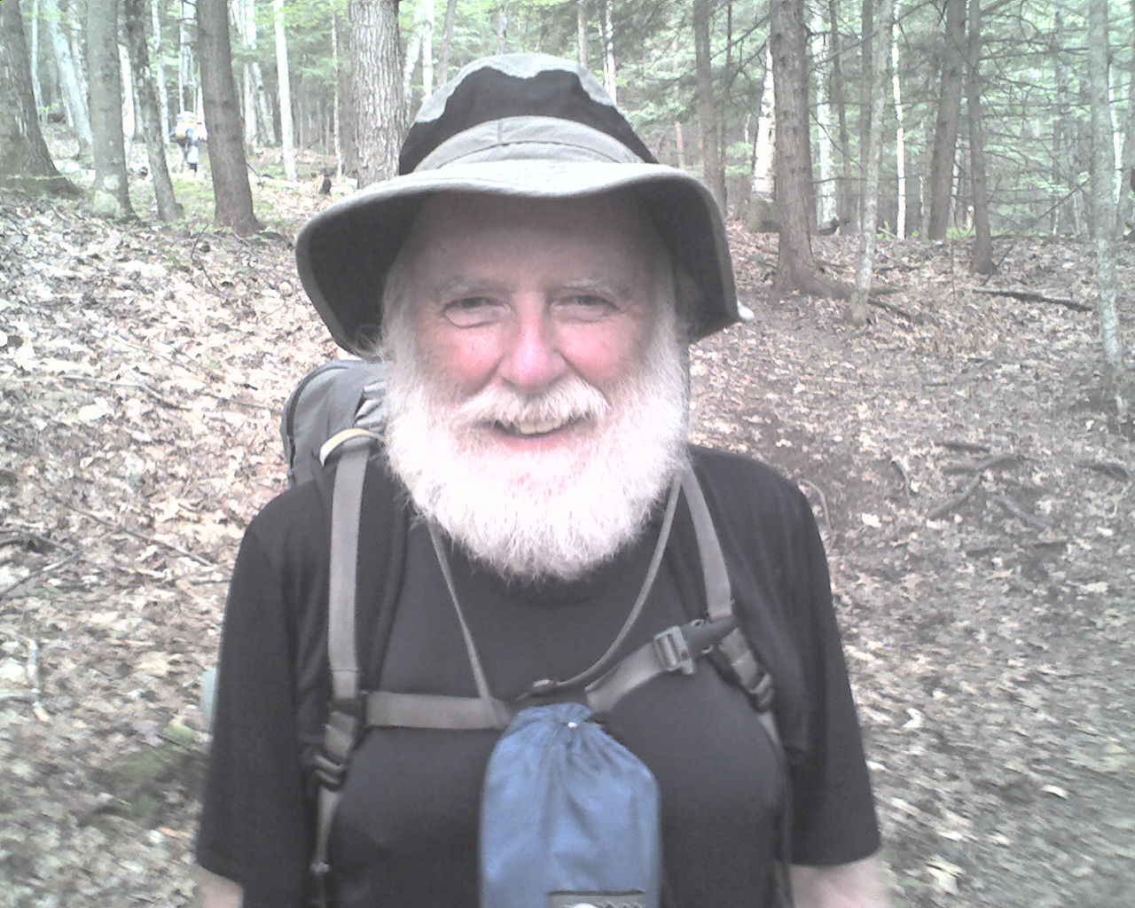
Today's photo is from several day's back but I wanted to share it with you. It's
Plugger, 68, the guy another hiker thought should be named Santa Claus. What do you think?
Today we walked from Lost Pond Shelter, trail mile 522.9 to VT Highways 11 & 30, Manchester Center, VT, trail mile 537.7, a total of 14.8 miles for the day.
May God's riches blessings, through Christ Jesus, our Lord and Savior, be yours.
|