 Sunday, October 4, 2009
Man vs. Mice
Location For The Night: Spring Mountain Shelter, trail mile 1,895.5
Miles Walked Today: 21.30
Day Number:
109
Flaxseed is on a mission; a mouse killing mission. He bought two mouse traps at the Dollar Store in Erwin, TN. Night before last he set both of them in the shelter. No luck. Apparently that shelter was mouse free. But last night was a different story. He caught two mice in about an hour. We were mouse free the rest of the night. Not Far, the 45 year-old mother of three, was elated. She hates mice. The traps snapping shut gave her great comfort. Thunderbird on the other hand had concerns. When the first trap snapped shut he asked Flaxseed what he was going to do with the mouse. Flax responded instantly. "Eat it," he said. Thunderbird remained silent.
We arose a little earlier than
usual and were on the trail at 7:02am. It was cloudy and mild all day until about 5:00pm when light rain began.
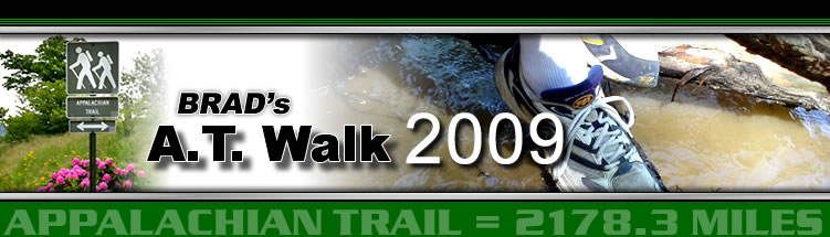
At 8:03am Thunderbird (who was yet in his sleeping bag when we left camp) passed us in a rush. We were on a climb and he was breathing hard and almost running. He is a speedy hiker, averaging around 28 miles per day to date from Maine to here. Yesterday he walked 37 miles. Today he's going all the way to Hot Springs, NC, a 36 mile walk. It's taking him two days to cover what cover in four. But, look at his photo. It was taken this morning when he caught us. Does this look like a man having fun or a man under a severe strain? You decide.
At 8:20am we passed a small, four grave cemetery. Two Shelton brothers that fought in the Civil War are buried there. Both were cavalry (mounted infantry) soldiers.
Fall colors are on the increase every day. A good frost will bring them on big time. That could happen any day now.
We walked hard today over moderate terrain. Our goal was a short day tomorrow into Hot Springs, NC. Flax's winter sleeping bag is at the post office and it closes at 4:00pm. And, we have a reservation at Elmer's Sunnybank Inn, a legendary AT long-distance hiker hostel that's been around since 1947. And, town food awaits.
At 7:10pm (almost dark) we arrived at Spring Mountain Shelter. Andrew, the lone hiker in residence, was courteous and helpful. He moved his gear to make room for us. We ate supper and retired. It's raining steadily now and turning colder. But, it's dry in here and both mouse traps are baited and set. What more could one ask for?
Today we walked from Flint Mountain Shelter, trail mile 1,874.2, to Spring Mountain Shelter, trail mile 1,895.5, a total of 21.3 miles for the day.
May the God of Abraham, Isaac and Jacob bless you and keep you.
 Monday, October 5, 2009
Elmer's
Location For The Night: Elmer's Sunnybank Inn, Hot Springs, NC, trail mile 1,906.5
Miles Walked Today: 11.00
Day Number:
110
Spring Mountain Shelter is appropriately named for last night's weather. It was as wet and cold as spring water. We were inundated with rain accompanied by fog. When the rain stopped the fog remained and dripping condensation continued. (You must be asking, "How many times do I have to hear about dripping condensation?") And, to make matters worse, the mice were smart. They stole the bait without tripping the traps and scampered around all night long. Flaxseed religiously tended his traps but only caught one mouse.
Because of the weather we waited an extra hour to let the fog lift and were on the trail at 8:11am. It remained cloudy and foggy through the morning, cleared by early afternoon and clouded up again tonight.
At 8:45am we got a brief glimpse of another bear. It was downhill about 30' east of the trail. It ran when it saw us. Most of them run. They want no part of us, only our food.
There were three small memorial stones along the trail today, each memorializing a person that loved walking on the AT. One inscription said the person's ashes were buried there.
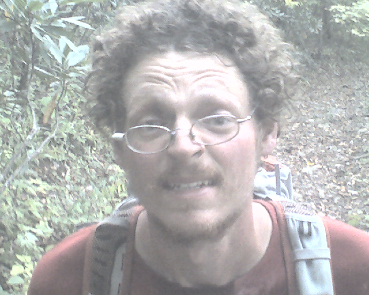
At 1:10pm we crossed the French Broad River (today's photo) and walked into Hot Springs, NC, a true trail town that loves hikers.
Flaxseed had a bonanza. First, he bought new hiking shoes and gaiters at Bluff Mountain Outfitters. Next, he picked up his winter sleeping bag at the post office. Cherry, his friend in Houston, did her job well. And, she sent candy and other goodies for both of us. Thanks Cherry.
We checked in at Elmer's Sunnybank Inn, an AT tradition. The owner, Elmer Hall, has served hikers here since 1947. It is an old Victorian home that sits high on a hill overlooking the town's main street.
Just across the street is the Smoky Mountain Diner, where we had double cheeseburgers and ice cream for lunch.
Flaxseed did our laundry and we both resupplied at Dollar General and the Hillbilly Market. Then we napped until 7:00pm, dinnertime at Elmer's. Three non-hiker guests joined us for dinner as did Elmer, Sean, Elmer's young business partner, and Daniel, a part-time employee here.
All the meals at Sunnybank Inn are vegetarian. Tonight was no exception. Sean prepared gormet style soup, salad and stir-fry vegetables on rice. He topped it off with hot spearmint tea and lemon pie. It was delicious. But, I still had to have my pint of ice cream and a pint of chocolate milk in our room, just for the calories of course.
Today we walked from Spring Mountain Shelter, trail mile 1,895.5, to Hot Springs, NC, trail mile 1,906.5, a total of 11.0 miles for the day.
Quoting Tennessee Ernie Ford, "May God bless every peapickin' one of you." (Youngsters should ask their grandparents about Tennessee Ernie Ford.)
 Tuesday, October 6, 2009
Long & Short
Location For The Night: stealth campsite near Hawks Roost, trail mile 1,930.2
Miles Walked Today: 23.70
Day Number:
111
We packed up quietly trying not to disturb the other guests and left Elmer's at 6:45am. We ate breakfast across the street at the Smoky Mountain Diner. I had three eggs, two pieces of sausage, wheat toast, and three large pancakes. A big breakfast really helps the first day out of town.
We hiked long and hard today so this report is going to be short. We are tired.
It was cloudy all day but did not start raining until 4:30pm, after we had passed Roaring Fork Shelter which would have given us 18 miles for the day. As the rain increased we decided to try to make it to the next shelter, 8.2 miles from Roaring Fork Shelter. But, at about 6:30pm the rain stopped and fog moved in. At 6:55pm we spotted a good stealth campsite about 100' west of the trail and pitched our tents quickly. We ate in dripping condensation with our headlights on, hung our food bags high (a food stealing bear is reported to be ravaging food bags in this area), and crawled in our tents for the night.
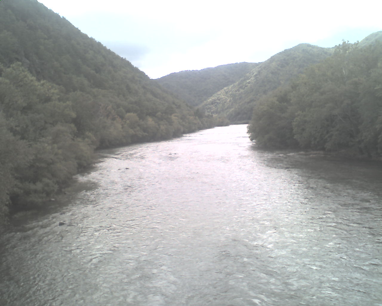
Today's photo shows the mountains, sky and fog (or mist) just before it started raining today. It was taken on top of Max Patch Summit.
Today we walked from Hot Springs, NC, trail mile 1,906.5, to a stealth campsite near Hawks Roost, trail mile 1,930.2, a total of 23.7 miles for the day.
God bless you all.
 Wednesday, October 7, 2009
Smoky Mountains
Location For The Night: Davenport Gap Shelter, trail mile 1,943.2
Miles Walked Today: 13.00
Day Number:
112
Dense fog and its accompanying drip was with us all night. Then, from 5:00-7:30am it rained. Rain or not, during the night Flaxseed set a trap in his tent's vestibule and caught one mouse.
We waited until the rain stopped, packed up and were walking at 8:30am.
Dripping continued for another two hours but it was evident the sun would win the day. By 11:30am the sky was mostly clear and the afternoon was perfect.
At 12:45pm we walked into Standing Bear Farm, another legendary AT hostel. It's a little rough around the edges as is its proprietor, Curtis Owen, who met us when we arrived. I picked up a drop box, we dried our wet gear, and Flaxseed bought a few food items from Curtis' pantry.
A hiker staying at the hostel drove us into Hartford, TN, for lunch. We enjoyed pulled pork barbecue sandwiches and topped them off with ice cream.
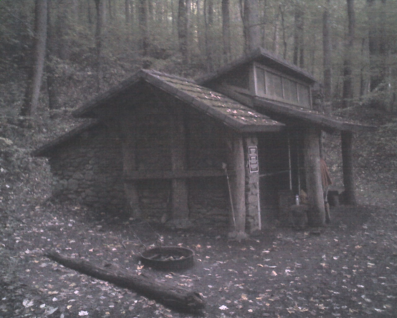
We left Standing Bear at 3:50pm and crossed the northern boundary of Great Smoky Mountains National Park at 4:55pm. From there we walked another .8 miles to Davenport Gap Shelter (today's photo). Tent camping is not allowed in the Smokys because of the bears. Shelter lodging is mandatory. This older shelter is built of native stone and has a heavy chain-link fence with a locked gate along its open front.
Today we walked from a stealth campsite near Hawks Roost, trail mile 1,930.2, to Davenport Gap Shelter, trail mile 1,943.2, a total of 13.0 miles for the day.
May God bless every last one of you.
 Thursday, October 8, 2009
Elevation Change
Location For The Night: Peck's Corner Shelter, trail mile 1,963.2
Miles Walked Today: 20.00
Day Number:
113
We were the lone guests at Davenport Gap Shelter last night. No other hikers showed up. But a few permanent residents met with an unexpected demise. Flaxseed trapped four mice.
We were on the trail at 7:02am. The weather was wonderful today. It was sunny all morning, partly cloudy this afternoon, and seasonably cool all day.
We did a lot of climbing today, reaching 6,417' on top of Mount Chapman. I roughly calculated the total elevation change for the day and came up with 10,000 vertical feet. This includes the ups and the downs. That's a lot of hills.
The Smokys are wilder and more remote than much of the rest of the AT. Most of the forest is so dense, particularly at the higher elevations, that bushwhacking (hiking off trail) would be impossible.
We hiked hard and a bit faster than usual today. At 4:45pm we reached our chosen destination, Peck's Corner Shelter, a 12 person shelter. We were the first to arrive. Eventually eight more section hikers arrived, all with reservations. In the Smokys through hikers are guaranteed four spots in each shelter without a reservation, but section hikers must have reservations issued in advance. Everyone must have a permit.
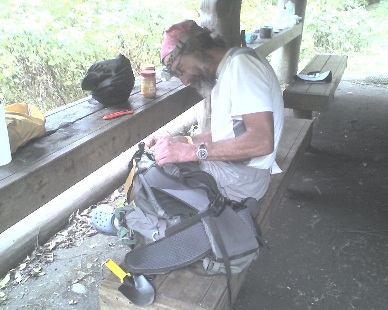
In today's photo Flaxseed is repairing his backpack a tonight's shelter. The stitching on one of the shoulder straps was coming loose.
Today we walked from Davenport Gap Shelter, trail mile 1,943.2, to Peck's Corner Shelter, trail mile 1,963.2, a total of 20.0 miles for the day.
God bless all of you.
 Friday, October 9, 2009
Weather Change
Location For The Night: Double Spring Gap Shelter, trail mile 1,984.4
Miles Walked Today: 21.20
Day Number:
114
Last night those that snored were relegated to one end of the shelter. Flaxseed, who has trouble sleeping around snoring, was happy with this arrangement, and, he caught one mouse. We had a good night.
We got started a little earlier today. We were walking at 6:27am with our headlamps on. It was foggy, windy and dark. The fog was thick as pea soup.
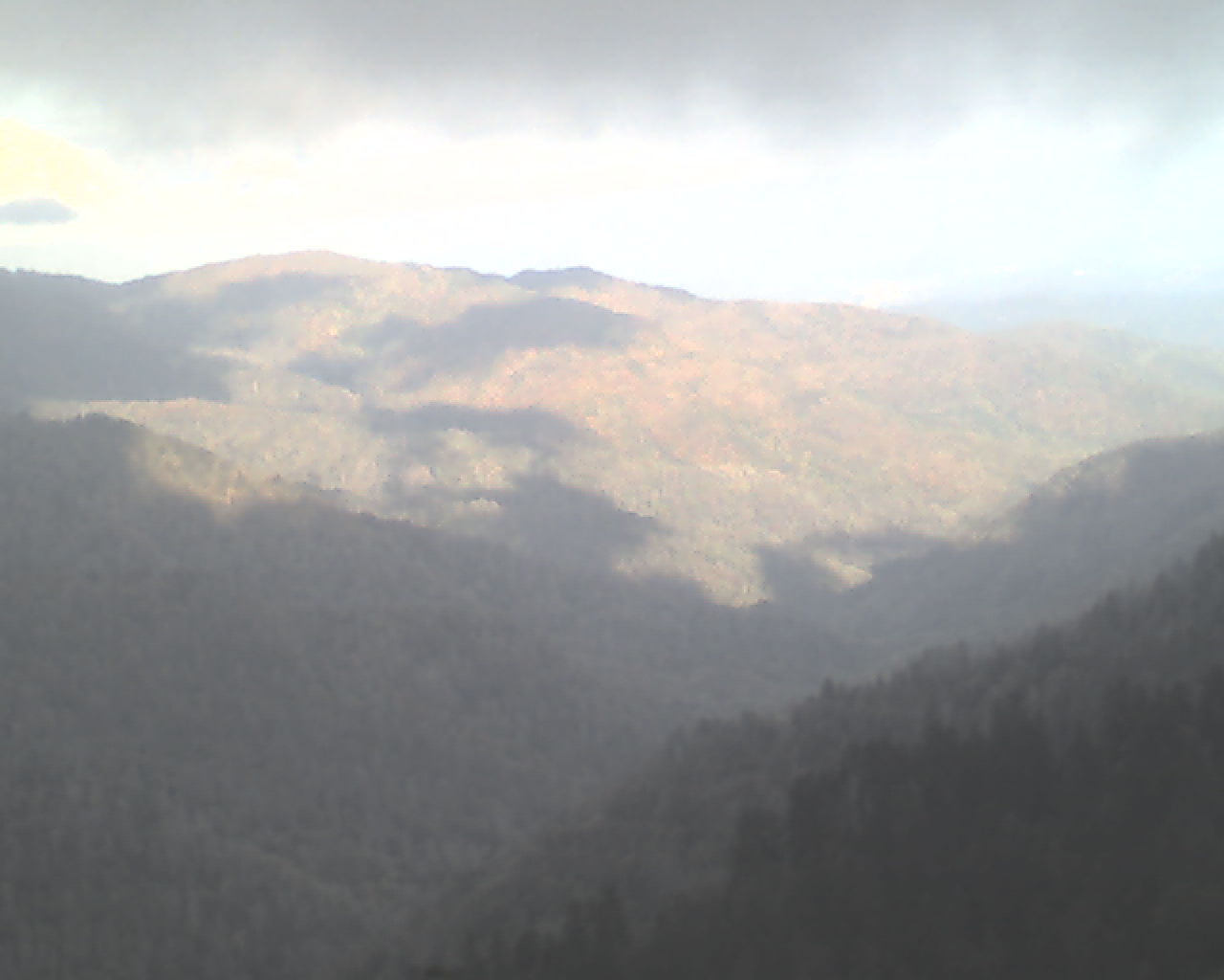
At 7:55am we saw a little blue sky and some sunlight on the distant mountains (today's photo). This lasted for about a hour and a half before heavy fog set in for the rest of the day. The Smoky Mountains earned their reputation today and it was a big change from the beautiful sunny day we had yesterday.
I'm no botanist or biologist, but it appears to me that the Smoky Mountains are the closest thing to a rain forest that we've got in the continental U.S. This truly is a wild and amazing botanical wilderness.
At 11:30am we arrived at Newfound Gap. The parking lot reminded me of a Wal-Mart parking lot on Saturday afternoon. It's a shame that the fog was so thick you couldn't see the mountains.
We continued on to Clingman's Dome (6,643'), the highest peak on the AT, arriving there at 3:50pm. Tourists were there too, climbing up the ramp to the observation deck. I have no idea what they were observing as the fog remained thick.
After we left Clingman's Dome it started to rain and the wind increased. It continued to rain (and drip) until we got to Double Spring Gap Shelter, our destination for the night. We arrived at 5:15pm.
Kentucky Blue, a young, female Ridgerunner from Florence, KY, greeted us and checked our permits. There was space in the shelter for both of us but Flaxseed was granted permission to pitch his tent. Joining me in the shelter are a group of high school students and their leader from northern Virginia and two young men from Chicago. It's 8:15pm and, amazingly, everyone here is quite as a mouse.
Today we walked from Peck's Corner Shelter, trail mile 1,963.2, to Double Spring Gap Shelter, trail mile 1,984.4, a total of 21.2 miles for the day.
May God bless you all.
 Saturday, October 10, 2009
Cold Fog
Location For The Night: Mollies Ridge Shelter, trail mile 2,003.3
Miles Walked Today: 18.90
Day Number:
115
A severe thunderstorm with abundant lightning raged from 9:00-11:00pm last night. I was warm and dry in the shelter. Flaxseed weathered the storm in his tent. After it was over more fog, with its never ending drip, moved in. But be not dismayed. Flaxseed and Ringmaster were back on the trail, bright eyed and bushy tailed (sort of), at 6:30am.
The fog, accompanied by light rain, was thick all morning. At about 11:20am it lifted for about an hour giving us a glimpse of the glorious fall colors on the mountains around us. They are not at their "peak" yet, but we've seen enough to not feel cheated.
This afternoon the fog grew even thicker and the temperature started to drop. The trail is wet and muddy. Our shoes and feet have been wet the past two days.
Bears were reported on the trail and at Spence Field Shelter today. One northbound hiker, John, who was planning to camp at Spence Field, decided to turn around and head south rather than take a chance on a bear encounter. He is here with us tonight.
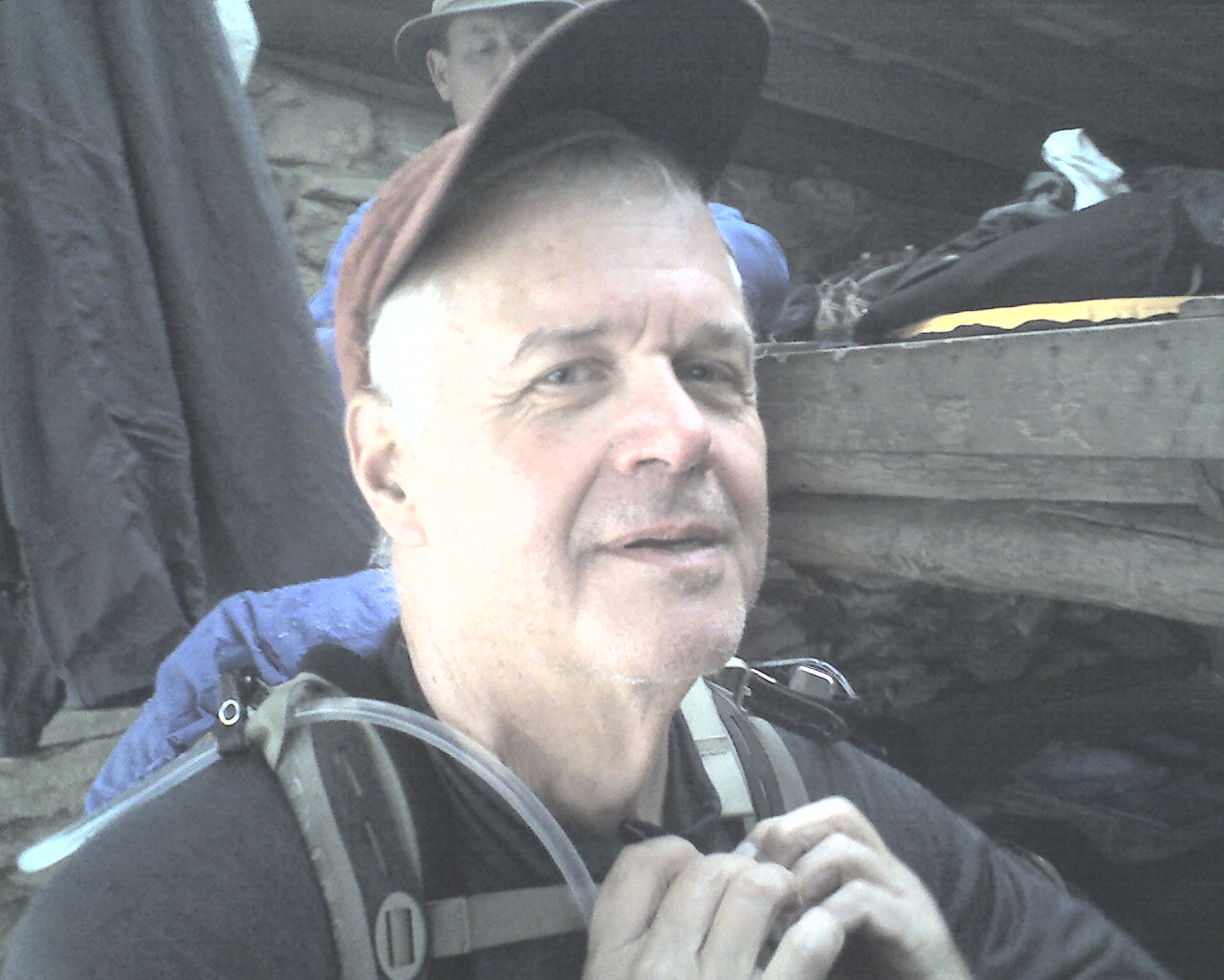
At 4:30pm we were the first arrivals at Mollies Ridge Shelter (4,360'). As we ate supper four others arrived. They are section hikers Hayne (69), David (50), and Pat (48), from Greenville, SC. John (22), the hiker that turned around to avoid bears is from Amesville, OH. Hayne is featured in today's photo.
As I finish typing at 7:45pm the fog is so thick one could cut it with a knife. The condensation from it is dripping on the shelter's metal roof. And, it's getting colder.
Today we walked from Double Spring Gap Shelter, trail mile 1,984.4, to Mollies Ridge Shelter, trail mile 2,003.3, a total of 18.9 miles for the day.
God bless everyone of you.
 Sunday, October 11, 2009
Grandchildren
Location For The Night: The Hike Inn, Fontana Dam, NC, trail mile 2,014.3
Miles Walked Today: 11.00
Day Number:
116
The Greenville, SC, boys were a mostly tolerable bunch. I say mostly because David snored all night. Hayne warned us about him and this morning he made sure David knew he was guilty as charged. It was fun listening to them poking fun at each other. Most mornings when we stay in a shelter we pack and eat silently because everyone is asleep. Today we all got up at the same time and shared trail talk and nonsense.
Flax and I were walking at 7:30am, a little later than the past several days because we had a short day ahead of us.
It was foggy and slightly dripping when we started. In a couple of hours the fog lifted and the sun came out. The rest of the day was warm and beautiful.
This morning I thought about assurance. On the trail two inch by six inch white blazes painted on trees, posts and rocks provide great assurance. Even with over 2,000 miles completed we continue to look for white blazes to assure us we are on the right trail. They give us great comfort, the comfort of assurance. Sometimes, after not seeing one for a while, I'll spot one up ahead and thank the Lord. When I pass by I may reach out and touch it just to show my appreciation. The same is true spiritually. The Lord Jesus is my white blaze. He is my comfort, assurance, and salvation. He provides direction. Without Him I have no direction. Without Him I am nothing. Do you have that same assurance? If not, why not trust Him today? He will provide that assurance.
At 12:30pm we crossed Fontana Dam and arrived at Fontana Dam Visitor's Center. Fifteen minutes later, Nancy, from The Hike Inn hiker motel picked us up and shuttled us down the road for barbecue.
At the motel, I picked up a drop box, we ate the barbeque in our room and showered while Nancy did our laundry.
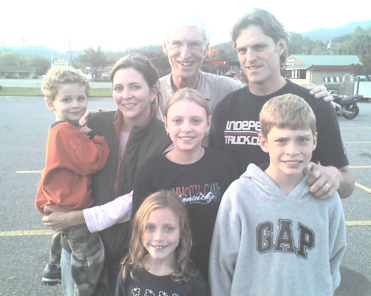
At about 4:25pm, just as Nancy was returning all our clean clothes (we were both wrapped in bath towels), a small, curly haired boy knocked on our door. Flaxseed opened it and told him he must have the wrong room. Then, much to my amazement, I heard my daughter-in-law's voice and recognized it instantly. Holly said, "We're looking for Granddad." Flax and I dressed quickly and walked outside to greet my son, Glen, and his family; Holly, Lily, Max, Hope and Jack (the curly haired boy at the door). They are on their way to Florida to visit my son, Sam, and his family, and drove out of their way on steep, twisting mountain roads to visit us on the trail. I was shocked; totally surprised. Thanks to all of you. I love you so much.
At 5:00pm Glen's family and I followed Nancy and Flax to Robbinsville, NC. We ate at a Mexican restaurant and drove to an Ingle's market to resupply. Glen joined us in the store. We took today's photo in the parking lot,
hugged and said goodbye. It was a bittersweet visit. Now I really want to get to the end of this thing.
Nancy drove Flax and me back to the motel, we sorted food, shared a 1.5 quart carton of chocolate ice cream, and Flax retired. That was an hour and a half ago. Give me ten more minutes on this PDA and I'll happily join him.
Today we walked from Mollies Ridge Shelter, trail mile 2,003.3, to Fontana Dam Visitor's Center, trail mile 2,014.3, a total of 11.0 miles for the day.
May the assurance by faith in the sacrificial death, burial and resurrection of the Lord Jesus Christ provide a blessing beyond all you could ask or hope.
 Monday, October 12, 2009
Gaps Galore
Location For The Night: Brown Fork Gap Shelter, trail mile 2,027.3
Miles Walked Today: 13.00
Day Number:
117
This morning we were up at 5:45am and packed by 6:30am. Breakfast was warmed up sausage biscuits and sweet rolls in Nancy's kitchen next to the motel. Jeff, Nancy's husband, shuttled us back to trail and we were walking again at 7:30am.
This was the first day of gun season for wild boar and black bear in North Carolina. On the drive back to Fontana Dam trailhead we saw numerous hunters parked along the side of the highway; some sitting in their vehicles, others gathered in groups. Most wore camo. Jeff explained the hunt this way: 1) The hunters turn their hounds loose at midnight. Some dogs wear locator collars. 2) They wait until their prey is treed (in a tree or cornered). 3) They follow the hounds baying and/or the locator signal to the dogs and the treed prey. 4) They shoot the boar or bear. Jeff said bear meat is not very good to eat. He said he'd just as soon eat ground hog.
Today's forecast called for a 90% chance of heavy rain. It was right on the money. It rained all day and is still raining as I type.
Today's walk took us through several gaps with interesting names. In only thirteen miles we walked through Walker Gap, Gum Gap, Low Creek Gap, Black Gum Gap, Cable Gap, Yellow Creek Gap, Cody Gap, Hogback Gap and Brown Fork Gap.
At 2:30pm we reached Brown Fork Gap Shelter where we set up residence for the night. This was a short day and an early stopping time for us, but the next shelter was another 9.1 miles over the top of a big mountain in the rain. And, it's only 16 miles from here to the Nantahala Outdoor Center in Wesser, NC, where we will be staying tomorrow night.
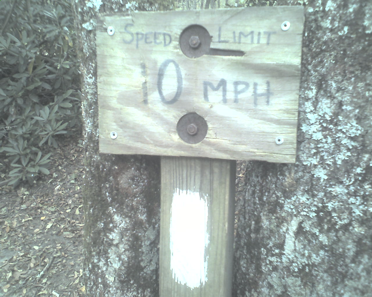
Today's photo is a sign above a white blaze warning hikers to slow down. It was taken a couple of weeks ago on a day without rain.
Today we walked from Fontana Dam Visitor's Center, trail mile 2,014.3, to Brown Fork Gap Shelter, trail mile 2,027.3, a total of 13.0 miles for the day.
God bless you all.
 Tuesday, October 13, 2009
Bear Hunters
Location For The Night: Nantahala Outdoor Center, Wesser, NC
Miles Walked Today: 16.00
Day Number:
118
Last night it rained into the early morning hours, fog and drip continued until about 6:00am. When we started our walk at 6:33am the sky had cleared, the moon was out, and the stars were brightly shining. The rest of the day was sunny and warm.
I forgot to tell you that we exited Smoky Mountains National Park two days ago when we reached Fontana Dam. We are now hiking in Nantahala National Forest.
In an earlier report I told you that AYCE is an AT acrostic for an "All You Can Eat" restaurant. Here's another one: PUDS, for "Pointless Ups & Downs". It refers to the fact that the AT seldom goes around a mountain, hill, knob or knoll. It incessantly finds the top of every bump.
At 7:30am we passed two bear hunters headed north from Stecoah Gap. They were dressed in blaze orange and each had a high-powered rifle slung over his shoulder. Four bear dogs with radio locator collars ran beside them. They were anxious to "put the dogs on a scent", but stopped just long enough to share the following: 1) When their dogs tree (or corner) a bear the dogs will fight the bear, often to the death (of the dog). 2) They field dress the bear and haul it out of the woods. 3) Bear meat eats real good.
It seems opinions on the culinary quality of bear meat vary.
At 1:43pm we encountered a northbound day hiker, not a hunter, with three bear dogs in tow. Here's the story. The dogs, all with radio collars, were following him up the trail. He was concerned that they were lost. He called a phone number on one of the collars. The hunter answered and asked the hiker to turn around and return the dogs to a dirt road at Wright Gap, about three miles south of the hiker's location. The goodhearted hiker agreed. From that point on we and the goodhearted hiker chaperoned all three hounds back to Wright Gap. Once there the hunter, in blaze orange, put his dogs in a box in the back of his pick-up with a whole passel of other dogs. He thanked us and asked us to keep a look out for two more dogs that were on the loose, Sam and June. We said we would, but, as we walked away, I wondered what purpose the locator collars served. I didn't ask him if he ate or liked bear meat.
At 2:55pm we arrived at Nantahala Outdoor Center in Wesser, NC. The AT runs through the middle of this large whitewater rafting complex. Our first stop was River's End restaurant for double 1/2 pound cheeseburgers and fries. We picked up some minor resupply items at the outfitter, checked into our lodge room, did laundry and cleaned up. I picked up a UPS box with another pair of shoes. By that time it was 6:45pm and we returned to River's End for supper. Flax ordered a large pizza. He ate some for supper, will eat some for breakfast, and stuff some in his pack for the trail. I had trout and a salad. We returned to our room for a pint of ice cream each.
Today's photo is Sarah, the hard working, courteous waitress that served us both lunch and supper.
Tomorrow's forecast is for a 100% chance of heavy rain. Flood warnings are all over the local news. We plan to be walking at 6:30am, but nothing about this thing is certain.
Today we walked from Brown Fork Gap Shelter, trail mile 2,027.3, to Nantahala Outdoor Center, trail mile 2,043.3, a total of 16.0 miles for the day.
May God richly bless you all.
|